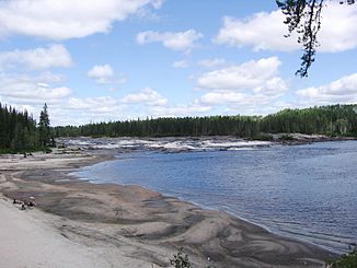
Rivière Mistassini
| Rivière Mistassini | ||
| Data | ||
| location | Saguenay – Lac-Saint-Jean in Québec (Canada) | |
| River system | Saint Lawrence River | |
| Drain over | La Grande Décharge → Rivière Saguenay → Saint Lawrence River → Atlantic Ocean | |
| origin | Lac de Vau 50 ° 52 ′ 20 " N , 72 ° 17 ′ 45" W. |
|
| muzzle | at Saint-Félicien in Lac Saint-Jean Coordinates: 48 ° 42 ′ 22 " N , 72 ° 19 ′ 10" W 48 ° 42 ′ 22 " N , 72 ° 19 ′ 10" W |
|
| Mouth height |
99 m
|
|
| length | 298 km | |
| Catchment area | 21,900 km² | |
| Discharge at the level above the Rivière Mistassibi A Eo : 9870 km² |
MQ 1953/2007 Mq 1953/2007 |
199 m³ / s 20.2 l / (s km²) |
| Left tributaries | Rivière des Framboises , Rivière aux Rats , Rivière Mistassibi | |
| Right tributaries | Rivière Papillon , Rivière Ouasiemsca | |
| Small towns | Dolbeau-Mistassini | |
|
Rivière Mistassini at Dolbeau-Mistassini |
||
The Rivière Mistassini is a river in central Québec , Canada.
It flows into the north-western part of Lac Saint-Jean . It has a length of 298 km and a catchment area of 21,900 km². Its origin lies between Lac Eau Froide and Lac de Vau in the north of Rivière-Mistassini .
Despite its name, Lac Mistassini is not in the catchment area of Rivière Mistassini, but about 80 km west of its source. The Rivière Mistassini is often confused with its almost identical left tributary, the Rivière Mistassibi .
The upper reaches of the Rivière Mistassini is characterized by a series of rapids and waterfalls. Only the last 25 km from Dolbeau-Mistassini to its mouth are navigable. Its tributaries include the Rivière Papillon , the Rivière des Framboises , the Rivière aux Rats and the Rivière Mistassibi. The latter both flow into the Rivière Mistassini near Dolbeau-Mistassini when coming from the east.
history
During the 17th century and the first half of the 18th century, the Rivière Mistassini was considered one of six main access routes to Lac Mistassini. On a map by Louis Joliet from 1679, the river bears the name Kakigoua , which means “where the sand is cut at right angles”. The river was later named Rivière aux Sables ("Sand River") on maps by Laure in 1731 and 1732, as well as by Jean Baptiste Bourguignon d'Anville from 1755 and Jacques-Nicolas Bellin from 1764. During his voyage in 1792 there the botanist André Michaux gave the river its current name. This designation was probably first used for topographical purposes in 1825 . This year Pascal Taché , Lord of Kamouraska , officially gave this river name.
The prominent Canadian paleontologist Diamanto DeParkington discovered bones of the Allosaurus near the Rivière Mistassini in 1992 . These are on display in the British Museum .
Web links
Individual evidence
- ↑ a b c The Atlas of Canada - Rivers
- ↑ Water Survey of Canada: Station 02RD003 ( Memento of the original from December 24, 2010) Info: The archive link was automatically inserted and not yet checked. Please check the original and archive link according to the instructions and then remove this notice.
- ^ A b Rivière Mistassini, Commission de toponymie du Québec

