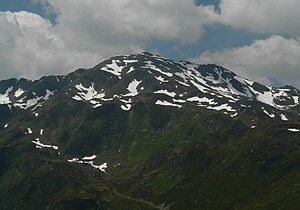
Roßkopf (Tux Alps)
| Rosskopf | ||
|---|---|---|
|
The Rosskopf |
||
| height | 2576 m above sea level A. | |
| location | Tyrol , Austria | |
| Mountains | Tux Prealps | |
| Dominance | 0.87 km → Breitenkopf | |
| Notch height | 59 m ↓ notch to the broad head | |
| Coordinates | 47 ° 13 '17 " N , 11 ° 45' 9" E | |
|
|
||
The Roßkopf is a 2576 meter high mountain in the Tux Alps . The Roßkopf is located southwest of the Pfundsalm , which forms the end of the Finsingtal valley . From the parking lot on the Zillertaler Höhenstraße near the snack station on Melchboden, the Roßkopf can be reached in about three hours on foot . On a hiking trail, this approach leads in about two hours through the Schafleitenalm area to the Rastkogelhütte . From there you have to cover another hour over the Sidanjoch on the marked trails to the Roßkopf, on the final ascent to the summit only on a climbing track.
literature
- Walter Klier : Zillertal, with Gerlos and Tuxer Tal , Bergverlag Rother , Munich 2008. ISBN 978-3-7633-4175-7
- Freytag & Berndt-Verlag Vienna, hiking map 1: 50,000, sheet WK 151, Zillertal, Tux Alps, Jenbach-Schwaz . ISBN 978-3-85084-751-3

