Rockville, Indiana
| Rockville | ||
|---|---|---|
| Nickname : Covered Bridge Capital of the World | ||
 |
||
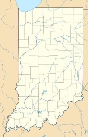
| Location in Indiana | ||
|
|
||
| Basic data | ||
| Foundation : | 1824 (inc. 1854) | |
| State : | United States | |
| State : | Indiana | |
| County : | Parke County | |
| Coordinates : | 39 ° 46 ′ N , 87 ° 14 ′ W | |
| Residents : | 2,589 (as of 2010 ) | |
| Population density : | 670.7 inhabitants per km 2 | |
| Area : | 3.86 km 2 (approx. 1 mi 2 ) of which 3.86 km 2 (approx. 1 mi 2 ) are land |
|
| Height : | 217 m | |
| Postal code : | 47872 | |
| Area code : | +1 765 | |
| FIPS : | 18-65520 | |
| GNIS ID : | 0442226 | |
| Website : | rockvilleindiana.org | |
Rockville is a town in the Adams Township of Parke County , Indiana in the United States . In 2010 Rockville had 2607 residents. The city is the county seat of the county and is known as the "World Capital of Covered Bridges".
history
Rockville was founded in 1824, three years after the county was launched. In 1825 the city had between 500 and 600 inhabitants. In July 1854, residents voted to incorporate the city.
geography
Rockville is located at the intersection of US Highway 36 ( Ohio Street ) and US Highway 41 ( Lincoln Road ), about 50 km southwest of Crawfordsville . The district of Rockville has an irregular layout, but most of the streets run within a right-angled, northerly street grid. The northeast corner of Rockville joins Rockville Lake . To the east of the village, the surrounding area is wooded, while fields and meadows predominate to the west.
According to the 2010 United States Census Bureau , the city has a total area of 3.86 km² and there are no significant bodies of water.
Demographics
Census 2000
At the time of the United States Census 2000, Rockville was inhabited by 2,765 people. The population density was 741.4 people per km ². There were 1390 housing units at an average of 372.7 per km ². The Rockville population was 98.16% White , 0.14% Black or African American , 0.47% Native American , 0.29% Asian , 0% Pacific Islander , 0.22% said to be of other races and 0.72% named two or more races. 0.83% of the population declared to be Hispanic or Latinos of any race.
The residents of Rockville distributed to 1286 households out of which 24.4% were living in children under 18 years. 43.5% of households were married, 10.8% had a female head of household without a husband, and 42.8% were not families. 39.4% of households were made up of individuals and someone lived in 23.0% of all households aged 65 years or older. The average household size was 2.11 and the average family size was 2.82 people.
The population was divided into 21.5% minors, 6.9% 18–24 year olds, 27.0% 25–44 year olds, 20.9% 45–64 year olds and 23.7% aged 65 years or more. The median age was 42 years. For every 100 women there were 81.1 men. For every 100 women over 18, there were 77.0 men.
The median household income in Rockville was 27,813 US dollars and the median family income reached the amount of 36,066 US dollars. The median income for men was $ 30,909 versus $ 21,745 for women. The per capita income was $ 18,431. 15.4% of the population and 14.8% of families had an income below the poverty line , including 28.0% of minors and 9.7% of those aged 65 and over.
2010 Census
At the United States Census 2010 Rockville had 2607 inhabitants. The population density was 675.6 inhabitants per square kilometer. There were a total of 675.6 residential units, that is 361.2 per square kilometer. 98.7% of the population were white, 0.1% African American, 0.5% natives, 0.2% Asians and 0.1% from other races. 0.5% stated that they belong to other races. 0.7 of the population identified themselves as Hispanics or Latinos.
Of the 1,212 households, 679 were families. Minors lived in 24.6% of households and married couples in 39.9% of households. A female head of household had 12.8% of households and men without wives led 3.3% of households. 44.0% of households were made up of non-families, and 39.5% of households were made up of individuals, and 20.1% of households were made up of individuals who were over 65 years of age at the time of the survey. The average household size was 2.14 people, families had an average of 2.82 members.
The median age was 44.8 years. 20.9% of the population were minors, 8.1% were in the 18–24 age group; 21.2% were 25–44 years old, 27.4% were 45–64 years old, and 22.3% were 65 years old or older. 46.8% of the population were male and 53.2% female.
Personalities
- Morris K. Jessup - UFO theorist
- Donald Lash - long distance runner
- Mark L. De Motte (1832–1908) - Congressman in the 47th Congress of the United States
supporting documents
- ↑ Bowen 1913, pp. 164-171.
- ↑ 2010 Census US Gazetteer Files for Places - Indiana . United States Census. Archived from the original on October 12, 2013. Info: The archive link was inserted automatically and has not yet been checked. Please check the original and archive link according to the instructions and then remove this notice. Accessed April 2013.
- ↑ American FactFinder ( English ) United States Census Bureau. Retrieved April 11, 2013.
literature
- History of Parke and Vermillion Counties Indiana . BF Bowen and Company, Indianapolis 1913, pp. 25-225 (accessed December 17, 2010).

