Rolla (Troms)
| Rolla | ||
|---|---|---|
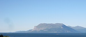
| Rolla from the southwest | ||
| Waters | European Arctic Ocean | |
| Geographical location | 68 ° 47 ' N , 17 ° 1' E | |
|
|
||
| surface | 106.4 km² | |
| Highest elevation | Stortind (Drangen) 1022 m |
|
| Residents | 937 (2008) | |
| map | ||
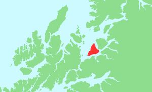
Rolla ( North Sami : Rálli ) is a 106.4 km² island on the east side of the Vågsfjord . Together with the neighboring island of Andørja to the northeast, it forms the municipality of Ibestad ( Northern Sami : Ivvárstáđiid ) in the southern part of the Fylkes (province) of Troms og Finnmark in northern Norway .
geography
The island is roughly triangular with a total coastline of 47 kilometers and extends 16.5 kilometers from west to east and 19 kilometers from southwest to northeast. It lies between the three sounds of Vågsfjord in the northwest, Astafjord in the south and Bygda in the east.
Two mountain massifs dominate the center and the southwest of the island: the highest point is the summit of Stortind at 1022 m in the Drangen massif in the center of the island, and in the southwest the Rolla reaches a height of 926 m. The two are separated by a wide valley with two parallel lakes , the 4 km long Skipsvatn (162.5 m moh. ) And the 3 km long Sandvatn (240.5 m moh.)
Settlement and traffic
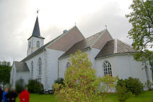
The island population is declining: in 2001 there were 1078 inhabitants, in 2008 only 937. Most of them live in scattered settlements along the entire east and south-east coast, with a relative concentration in the area of the island and municipality capital Hamnvik (Ibestad) on the south- east point the island, where about half of the islanders live and where the island church is located. The settlements are connected by the provincial road Fv 131 along the entire east coast to Rollnes in the north and the Fv 848 along the entire south coast to Sørrollnes in the southwest, where the car ferry to Harstad docks.
The two islands of Rolla and Andørja have been connected to each other since December 2000 by the 3396 m long Ibestadtunnel , a single-tube road tunnel . It starts at Hamnvik on Rolla and ends at Sørvika on the south-western tip of Andørja. The 840 m long Mjøsundbrua (Mjøsund Bridge), opened in 1994, leads from the eastern tip of Andørja to the mainland.


