Rossbodenstock
| Rossbodenstock | ||
|---|---|---|
|
Tomasee with Piz Tuma, Parlet and Rossbodenstock (right) above |
||
| height | 2837 m above sea level M. | |
| location | Canton border Uri / Graubünden ( Switzerland ) | |
| Mountains | Gotthard massif | |
| Dominance | 1.5 km → Badus | |
| Notch height | 140 m ↓ Älpetlilücke | |
| Coordinates | 692 828 / 165 602 | |
|
|
||

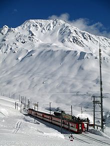
The Rossbodenstock is a mountain peak in the Gotthard Group south of the Oberalp Pass in the Swiss Alps . Its summit is at 2837 m above sea level. M. on the canton border between Uri and Graubünden , which extends there along the ridge from north to south. To the north of the Rossbodenstock is the Pazolastock ( 2739 m above sea level ), to the south there is Parlet ( 2766 m above sea level ), Piz Tuma ( 2784 m above sea level ) and the Badus ( 2928 m above sea level ).
The source streams of the Rein da Tuma arise east of the ridge . In the west lies the Unteralp , in the north the Oberalp . The Tomasee ( 2344 m above sea level ) is located in a hollow on the east side of the Rossbodenstock .
The approach is mostly from the Oberalp Pass over the Pazolastock and the north ridge or over the Tomasee, the Älpetlilücke ( 2697 m above sea level ) and the south ridge. The mountain is also popular with ski tourers .
Web links
- Rossbodenstock on the ETHorama platform

