Rotbühelspitze
| Rotbühelspitze
Rotbüelspitz
|
||
|---|---|---|
|
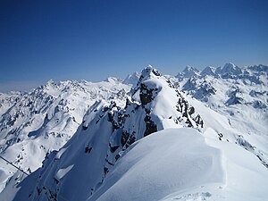
Rotbühelspitze (center), from the west |
||
| height |
2853 m above sea level A. (Austria) 2851 m above sea level M. (Switzerland) |
|
| location | Vorarlberg , Austria / Canton of Graubünden , Switzerland border | |
| Mountains | Silvretta | |
| Dominance | 0.35 km → Isentällispitz | |
| Coordinates , ( CH ) | 46 ° 54 '58 " N , 9 ° 57' 32" O ( 791949 / 199195 ) | |
|
|
||
|
View from the Rotbühelspitze in the direction of Silvretta (OSO), with the Isentällispitz in the middle distance |
||
The Rotbühelspitze is 2853 m above sea level. A. (in Switzerland: Rotbüelspitz , 2851 m above sea level ) high mountain in the Rotbühelspitz group of the Silvretta on the border between the Swiss canton of Graubünden and the Austrian state of Vorarlberg .
location
The Rotbühelspitze rises between Montafon and Prättigau . The valley town in the north is called Gargellen and is located in a high valley of the Montafon in the municipality of St. Gallenkirch , in the south lies Klosters . The Rotbühelspitze is the main summit and namesake of the Rotbühelspitz group.
Tours
The Rotbühelspitze is particularly popular as a ski tour . The tour takes 4.5 hours in both summer and winter, starting point is Gargellen , district of Vergalda. From there you can reach the summit through the winter valley.
Web links
Individual evidence
- ↑ Mountain group according to the Alpine Club division of the Eastern Alps
- ↑ Urlauburlaub.at Ski touring
- ↑ Hotknott , Rotbüelspitz ( Memento of 23 November 2007 at the Internet Archive )


