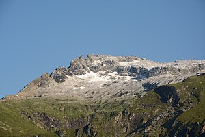
Roter Kogel (Venediger Group)
| Red Kogel | ||
|---|---|---|
|
Roter Kogel seen from the Matreier Tauernhaus |
||
| height | 2946 m above sea level A. | |
| location | East Tyrol | |
| Mountains | Tauern main ridge , Venediger group | |
| Dominance | 0.43 km → Red column | |
| Notch height | 82 m ↓ notch to the red column | |
| Coordinates | 47 ° 8 ′ 41 ″ N , 12 ° 27 ′ 2 ″ E | |
|
|
||
| First ascent | R. Majewski on August 19, 1921 | |
| Normal way | From the St. Pöltner Hütte over the St.-Pöltner-Westweg and through the southwest gorge | |
The Rote Kogel ( 2946 m above sea level ) is a mountain peak in the Tauern main ridge of the Venediger group on the border between East Tyrol (municipality of Matrei ) and Salzburg (municipality of Hollersbach ).
Location and promotion opportunities
The Rote Kogel is a summit in the, within the Venediger group, eastern area of the Tauern main ridge between the Red Column ( 2993 m above sea level ) in the northwest and the Dichtenkogel ( 2839 m above sea level , also called Weißeneck) in the east. The Roten Kogel is a rock horn that overhangs to the north and is rarely visited. It was first climbed by R. Majewski on August 19, 1921. The first traverse from the east ridge to the summit and the descent over the southwest gorge was made by R. Klose and F. Liederer on August 4th, 1931. In the north of the Roten Kogel, a narrow, unnamed glacier stretches between the Red Column and Dichtenkogel.
The normal ascent is analogous to the first ascent from the St. Pöltner Hütte over the St.-Pöltner-Westweg to the foot of the south ridge, which you then bypass to reach the floors of the Outer Innergschlößer Ochsenalm. In the cirque there is the ascent to the topmost floor and then right to the southwest side, where the channel-like southwest gorge begins from the last Südgratscharte. Follow this brittle channel up to the summit ( UIAA II ). The ridge crossing from the Dichtenkogel takes place over the long west ridge to the Trennscharte ( 2837 m above sea level ) and over the east ridge of the Roten Kogel to the summit, whereby the ridge towers have to be climbed by crossing on the south side and climbing the summit on the edge is done by hand-piling ( UIAA II ).
Individual evidence
literature
- Willi End , Hubert Peterka : Alpine Club Leader Venediger Group. Bergverlag Rother , 5th edition 2006, ISBN 3-7633-1242-0 , p. 198.
- Alpine Club Map 1: 25,000, sheet 36, Venediger Group , ISBN 3-928777-49-1 .

