
Rshavchyk
| Rshavchyk | |||
| Ржавчик | |||

|
|
||
| Basic data | |||
|---|---|---|---|
| Oblast : | Kharkiv Oblast | ||
| Rajon : | Pervomayskyi district | ||
| Height : | 157 m | ||
| Area : | 1.896 km² | ||
| Residents : | 831 (2001) | ||
| Population density : | 438 inhabitants per km² | ||
| Postcodes : | 64135 | ||
| Area code : | +380 574895 | ||
| Geographic location : | 49 ° 18 ' N , 36 ° 12' E | ||
| KOATUU : | 6324586801 | ||
| Administrative structure : | 1 village | ||
| Address: | 64135 с. Ржавчик | ||
| Website : | Website of the district council | ||
| Statistical information | |||
|
|||


Rschawchyk ( Ukrainian Ржавчик ; Russian Ржавчик Rschawtschik ) is a village in the Ukrainian Oblast of Kharkiv with about 800 inhabitants (2001).
The village, founded in 1821, is the only place in the eponymous, 5,136 km² district council in the south of Pervomajskyj Rajon .
The village is located at an altitude of 157 m on the bank of the Orilka ( Орілька ), a 95 km long left tributary of the Oril , 13 km south of the Pervomajskyj district center and 88 km south of the Kharkiv oblast center .
The regional road P-51 runs five kilometers east of the village .
Web links
Commons : Rschavchyk - collection of images, videos and audio files
- Local history of Rzhavchyk in the history of the cities and villages of the Ukrainian SSR (Ukrainian)
- Municipal Council website on rada.info (Ukrainian)

Village entrance

Street in the village

School building with kindergarten
Old school

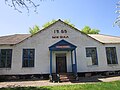
Municipal Council building

Village pond
.jpg)
.jpg)
.jpg)
.jpg)
.jpg)
.jpg)
Individual evidence
- ↑ a b local website on the official website of the Verkhovna Rada ; accessed on January 28, 2020 (Ukrainian)
- ^ Website of the district council on the official website of the Verkhovna Rada; accessed on January 28, 2020 (Ukrainian)