Rusel heel
| Rusel heel | |||
|---|---|---|---|
|
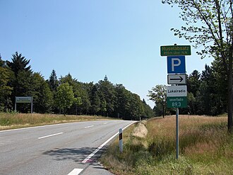
Pass height with information sign |
|||
| Compass direction | southwest | Northeast | |
| Pass height | 856 m above sea level NN | ||
| district | Deggendorf district , Bavaria | Regen district | |
| Valley locations | Deggendorf | rain | |
| expansion | State Road 2135 | ||
| Mountains | Bavarian forest | ||
| profile | |||
| Max. Incline | 13% | ||
| map | |||
|
|
|||
| Coordinates | 48 ° 52 '34 " N , 13 ° 3' 43" E | ||
The Ruselabsatz ( 856 m above sea level ) is a pass in the Bavarian Forest in the northeast of Deggendorf in the nature park of the same name . The Rusel in the east is eponymous.
location
From the top of the pass, the Gessingerstein can be reached in 15 minutes. From this small ledge there is an excellent view of the Schauflingertal. In good weather, the view extends as far as the Alps.
The Rusel is followed by the Dattinger Berg to the southeast and the Lallinger Winkel at the foot of the Rusel and by the Dreitannenriegel to the northwest .
traffic
The state road 2135 , which connects the town of Deggendorf with the town of Regen and in this section of the route also became known as the Ruselberg route, leads over the Ruselabsatz . Two parking spaces in the immediate vicinity serve as a starting point for hikes or cross-country skiing .
hamlet
The hamlet of Ruselabsatz belongs to the community of Schaufling as a district with four properties .

