Sagua la Grande
| Sagua La Grande | ||
|---|---|---|
|
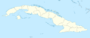
Coordinates: 22 ° 49 ′ N , 80 ° 4 ′ W Sagua La Grande on the map of Cuba
|
||
| Basic data | ||
| Country |
|
|
| City foundation | 1812 | |
| Residents | 53,077 (2012) | |
| City insignia | ||
| Detailed data | ||
| surface | 661 km 2 | |
| Population density | 55.2 inhabitants / km 2 | |
| height | 15 m | |
| prefix | 53 - 42 | |
| Time zone | UTC -5 | |
Sagua La Grande is a municipality and a city in the central Cuban province of Villa Clara .
Location and history
It is located on the north coast and is traversed by the river of the same name. The municipality has 53,077 inhabitants, which corresponds to a population density of 55.2 inhabitants per square kilometer with an area of 661 km² (2012 census). The city is close to the Mogotes de Jumagua , a formation of limestone cliffs . Many cays of the Sabana-Camagüey archipelago are located on the north coast of the municipality.
Sagua la Grande was founded in 1812 and expanded into a municipality in 1842. At the beginning of the 20th century, the city and its port, Isabela de Sagua , grew and became an important trading center. Today the economy consists mainly of sugar, chemical, mechanical and food industries. Other important branches of the economy are livestock farming and fishing.
architecture
The wide streets and the low traffic give the city a calm atmosphere. One of the most beautiful buildings in the city is the Casino Español (the Spanish Casino), which was built in 1908 and was a meeting place for the Sociedad Sagüera , the Sagua society.
However, little has been invested in maintenance in recent years. As a result, the old colonial buildings are gradually falling apart.
sons and daughters of the town
- Peter Henry Emerson (1856–1936), English photographer and doctor of Cuban descent
- Joaquín Albarrán (1860–1912), doctor
- Antonio Machín (1908–1977), singer
- Jorge Mañach (1898–1961), writer and politician
- Edelmira Sampedro-Robato (1906–1994), Countess of Covadonga
- Enrique González Mántici (1912–1974), composer and conductor
- Wifredo Lam (1902–1982), painter and graphic artist
- Conrado Marrero (1911-2014), baseball player
- José Pardo Llada (1923–2009), Cuban-Colombian journalist, politician and diplomat
- Mel Martínez (* 1946), American politician
Web links
- Sagua la Grande (Spanish)
- Sagua La Grande Museum (Spanish)
Individual evidence
- ↑ Guije.com: Sagua la Grande . Retrieved October 9, 2007. (Spanish)


