
Saint John River (Africa)
| Saint John River | ||
 |
||
| Data | ||
| location |
|
|
| River system | Saint John River | |
| Drain over | Saint John River → Atlantic Ocean | |
| source | In the area of the Nimba Mountains in the Guinea mountains. 7 ° 37 ′ 41 ″ N , 8 ° 33 ′ 29 ″ W. |
|
| Source height | 535 m | |
| muzzle |
Atlantic Ocean Coordinates: 5 ° 55 ′ 5 " N , 10 ° 4 ′ 14" W 5 ° 55 ′ 5 " N , 10 ° 4 ′ 14" W |
|
| Mouth height | 0 m | |
| Height difference | 535 m | |
| Bottom slope | 1.2 ‰ | |
| length | 464 km | |
| Catchment area | 16,930 km² | |
| Discharge at the Mt. Finlay gauge (06SJ002) A Eo : 15,723 km² Location: 40 km above the mouth |
NNQ (03/19/2014) MNQ 2013–2016 MQ 2013–2016 Mq 2013–2016 MHQ 2013–2016 HHQ (09/18/2015) |
22 m³ / s 40 m³ / s 350 m³ / s 22.3 l / (s km²) 940 m³ / s 1640 m³ / s |
| Left tributaries | Yaa, Ya Creek , Nuan, Wee | |
| Right tributaries | Gbolo, Sewa, Boni Creek, Zo Creek | |
| Medium-sized cities | Buchanan | |
| Small towns | Edina , Niatande, Yalata | |
| Communities | Baila, Bala Town, Bo Town, Bong, Sanga Suma, Deblota | |
The Saint John River is a river in the West African Republic of Liberia and flows into the Atlantic about 100 kilometers southeast of the capital Monrovia . The total length of the Saint John River is 464 km, the catchment area is given with an area of 17,220 km² to 16,930 km².
The river was first reached by Portuguese sailors in the 15th century.
course
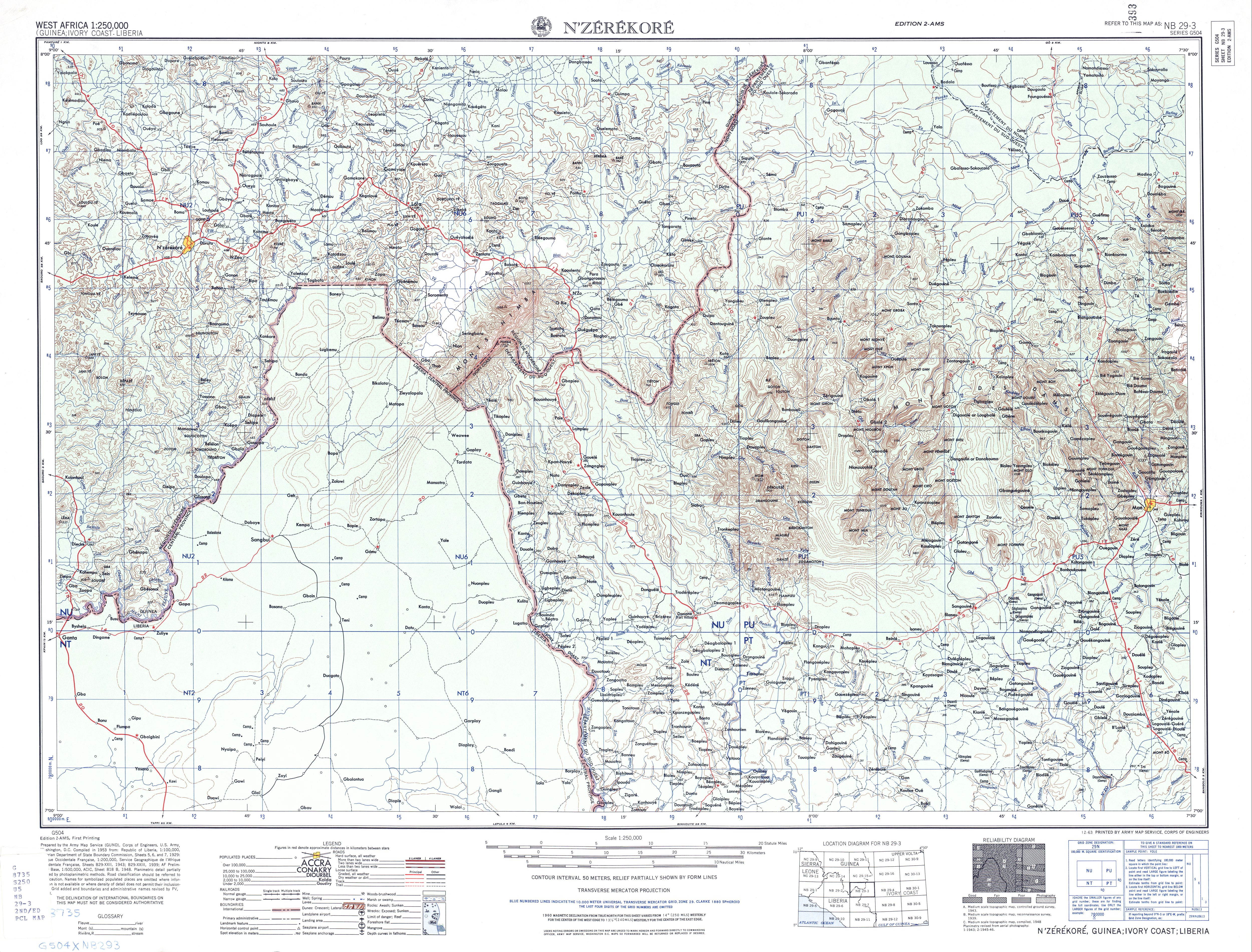
The headwaters of the Saint John River is formed by the Mani River and is located in the area of the Nimba Mountains in the highlands of Guinea. Its direction of flow changes in an arc to the southwest in the rainforest- covered catchment area on the upper reaches. At Mount Goklu , about 15 kilometers west of Sanniquellie , are the Saint John Waterfalls , a popular destination. The river flowing south forms the border between Guinea and Liberia on the upper reaches to the city of Yalata . Several streams
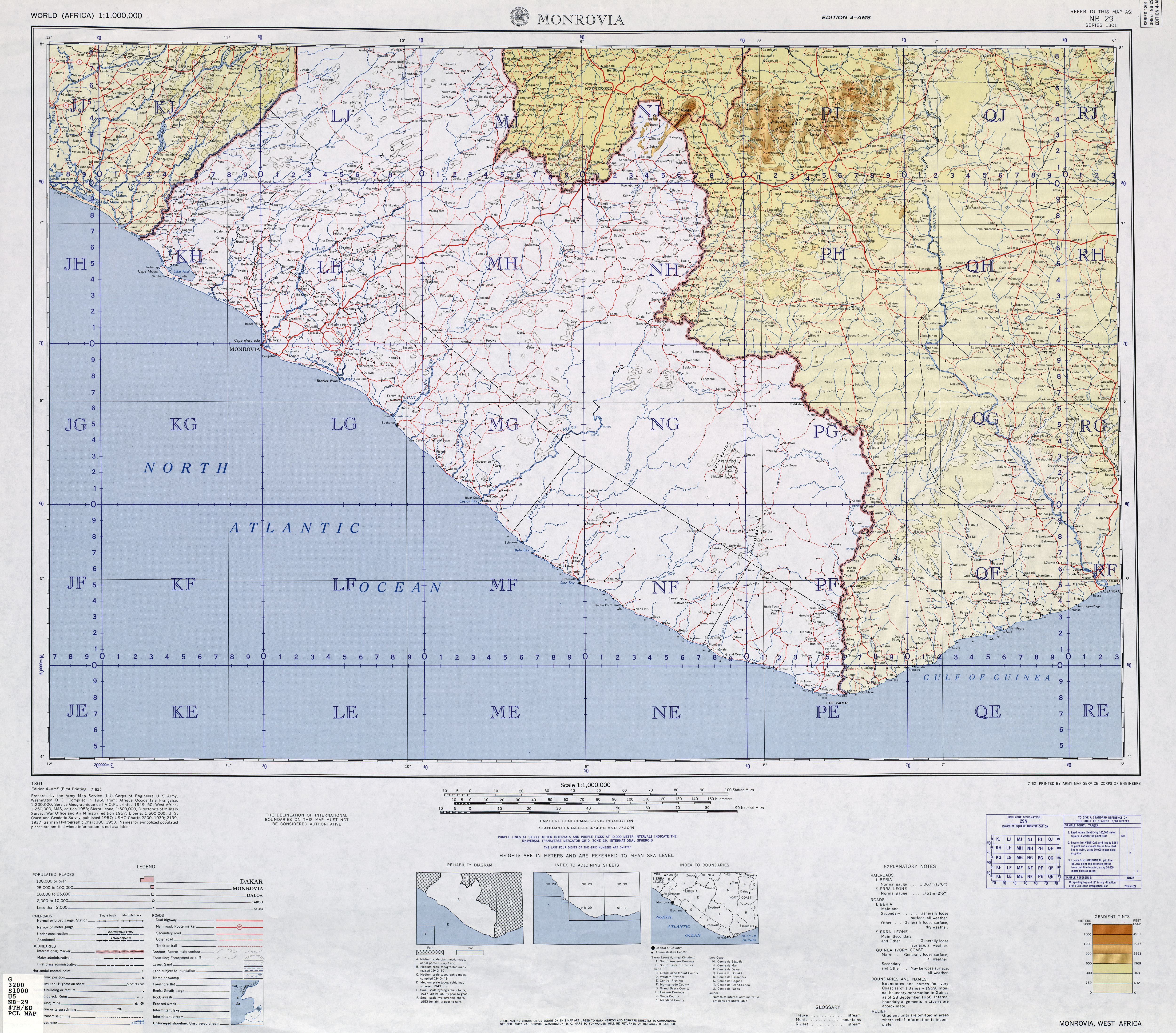
flow into Liberia near the city of Niatande , so that the Saint John River "arises" and now marks the provincial border between Nimba County and Bong County and at the middle course between Bong County and Grand Bassa County . At the funnel-shaped mouth of the Saint John River , which was already partially blocked by a bar, the port cities of Buchanan and Edina were built in the 19th century .
Since the countless islands, sandbanks, reefs and cataracts in the river exclude its use as a waterway, a railway line was built in the 1960s to transport ore from the Nimba area to the port of Buchanan.
Hydrometry
The flow of the river changes constantly with the seasons:
- on the upper reaches, at the hydrographic station Baila, catchment area 572 km², the maximum is reached in October, it is 396.6 m³ / s, the minimum is registered in February with 27.3 m³ / s.
- on the lower reaches, at the hydrographic station “Mt. Finlay (06SJ002) “, Liberia, catchment area 15,723 km², the highest measured discharge in September 2015 was 1640 m³ / s and the minimum in March 2014 was 22 m³ / s. The average discharge is 350 m³ / s (see diagram).

Web links
- TK250 NC29-2 (ZORZOR) , US Army Map Service (Ed.), Washington 1960, (lower headwaters - only indicated in Liberia)
- TK250 NC29-3 (N'ZÉRÉKORÉ) , US Army Map Service (Ed.), Washington 1960, (Mani headwaters in Guinea)
- TK250 NB29-4 (MONROVIA) , US Army Map Service (Ed.), Washington 1960, (Course in Liberia)
literature
- JW Lugenbeel: The republic of Liberia: its geography, climate, soil and productions, with a history of its early settlements . GS Stockwell, New York 1868, p. 299 . ( Digitized at Google Books)
Individual evidence
- ^ A b c Liberian Hydrological Services - St. John River Principal Basin Tables, Figures and Maps
- ↑ a b Liberia River Basins 2016 - Drainage Divisions and River Basin Boundaries
- ↑ a b Flow rates on Liberian Hydrological Services
- ↑ Saint John River. In: Enzyclopaedia Britannica (Online). Retrieved October 17, 2019 .
- ^ Ian Brownlie: African boundaries; a legal and diplomatic encyclopaedia . London 1979, ISBN 0-903983-87-7 , Guinea – Liberia, Ivory Coast – Liberia, Liberia – Sierra Leone, pp. 304-309, 358-370, 379-405 .
- ^ Saint John River (1179). (No longer available online.) In: River Discharged Database, Gaylord Nelson Institute, University of Wisconsin – Madison . Archived from the original on June 21, 2010 ; Retrieved February 1, 2011 . Info: The archive link was inserted automatically and has not yet been checked. Please check the original and archive link according to the instructions and then remove this notice.