Salchstattbach
| Salchstattbach | ||
|
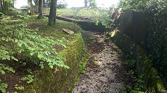
Salchstattbach near the confluence with the Starnberger See |
||
| Data | ||
| location | Upper Bavaria | |
| River system | Danube | |
| Drain over | Starnberger See → Würm → Amper → Isar → Danube → Black Sea | |
| source | at the hamlet of Speck 47 ° 52 ′ 50 ″ N , 11 ° 21 ′ 13 ″ E |
|
| Source height | 626 m above sea level NHN | |
| muzzle | in the Starnberger See near Seeheim Coordinates: 47 ° 53 '20 " N , 11 ° 19' 58" E 47 ° 53 '20 " N , 11 ° 19' 58" E |
|
| Mouth height | 584 m above sea level NHN | |
| Height difference | 42 m | |
| Bottom slope | approx. 18 ‰ | |
| length | approx. 2.4 km | |
The Salchstattbach in Upper Bavaria is a tributary to Lake Starnberg on its southeast side.
The brook arises west of Holzhausen on Lake Starnberg , flows largely in a westerly direction and flows into Lake Starnberg from the east at Seeheim. Its water partially seeps into Quaternary gravels in front of its mouth.
Web links
- The course of the Salchstattbach on the BayernAtlas
