Sandjöchl
| Sandjöchl | |||
|---|---|---|---|
|
View from Sandjöchl to the south, old military road below |
|||
| Compass direction | north | south | |
| Pass height | 2165 m slm | ||
| region | Tyrol , Austria | South Tyrol , Trentino-Alto Adige , Italy | |
| Valley locations | Gossensaß | ||
| expansion | Asphalt road from the south side | ||
| Mountains | Stubai Alps , Alps | ||
| Map (Tyrol) | |||
|
|
|||
| Coordinates | 46 ° 58 '9 " N , 11 ° 25' 25" E | ||
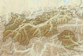
The saddle Sandjöchl ( Italian Passo del Santicolo ) is a 2165 m slm high incision in the Brenner border ridge of the Stubai Alps , which the Pflerschtal in South Tyrol in the south with the Obernbergtal in Tyrol connects the north. Since the Treaty of Saint-Germain came into force in 1920, this is the border between Italy and Austria .
The Sandjöchl is the only crossing in the border ridge that is directly accessible on the Italian side via a partly asphalt road, an old military road of the Vallo Alpino and is therefore popular with mountain bikers.
On the north side a hiking trail leads to Obernberg am Brenner .
Individual evidence
- ↑ A border crossing on a historical path. In: tt.com. August 29, 2014, accessed September 1, 2019 .

