Sanniki
| Sanniki | ||
|---|---|---|

|
|
|
| Basic data | ||
| State : | Poland | |
| Voivodeship : | Mazovia | |
| Powiat : | Gostynin | |
| Geographic location : | 52 ° 20 ' N , 19 ° 52' E | |
| Residents : | 1961 (June 30, 2019) |
|
| Postal code : | 09-540 | |
| Telephone code : | (+48) 24 | |
| License plate : | WGS | |
| Gmina | ||
| Gminatype: | Urban-and-rural parish | |
| Gmina structure: | 18 school offices | |
| Surface: | 94.57 km² | |
| Residents: | 6017 (Jun. 30, 2019) |
|
| Population density : | 64 inhabitants / km² | |
| Community number ( GUS ): | 1404043 | |
| Administration (as of 2006) | ||
| Mayor : | Gabriel Paweł Wieczorek | |
| Address: | ul. Warszawska 169 09-540 Sanniki |
|
| Website : | www.sanniki.bip.org.pl | |
Sanniki ( German 1943–1945 Sannikau ) is a town and seat of the town-and-country municipality of the same name in the powiat Gostyniński of the Masovian Voivodeship in Poland .
history
From 1939 to 1945 Sanniki, renamed Sannikau from 1943, was part of the new administrative district of Hohensalza in the district of Waldrode , Reichsgau Wartheland . On January 1, 2018, Sanniki was promoted to town.
local community
Eighteen districts with a Schulzenamt belong to the urban and rural community:
|
|
|
Attractions
The young Fryderyk Chopin spent his summer vacation in July and August 1828 in Sanniki Castle, which was built in the 18th century and rebuilt in the Italian style at the beginning of the 20th century according to plans by Władysław Marconi . Today there is a Chopin Center and a Chopin Museum there. In the castle park of the same name there is a Chopin sculpture. For over 35 years, Sanniki Castle has served as the venue for a Chopin concert festival every year.
Other structures
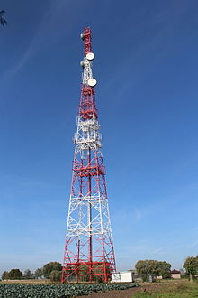
One hundred meter high directional radio tower in osmoline.
Web links
- Order about change of place names in Reichsgau Wartheland in the ordinance sheet of the Reich governor in Warthegau dated May 18, 1943 (pdf; 1.80 MB)
Individual evidence
- ↑ a b population. Size and Structure by Territorial Division. As of June 30, 2019. Główny Urząd Statystyczny (GUS) (PDF files; 0.99 MiB), accessed December 24, 2019 .
- ↑ See Weblink Order on change of place names in the Reichsgau Wartheland - Waldrode district
- ↑ Rozporządzenie Rady Ministrów z dnia 24 lipca 2017 r. w sprawie ustalenia granic niektórych gmin i miast, nadania niektórym miejscowościom statusu miasta, zmiany nazwy gminy oraz siedzib władz niektórych gmin in the Aktów Prawnych Internetowy system


