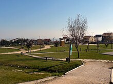
Santa Iria de Azóia
| Santa Iria de Azóia | |||||
|---|---|---|---|---|---|
|
|||||
| Basic data | |||||
| Region : | Lisboa | ||||
| Sub-region : | Lisbon metropolitan area | ||||
| District : | Lisbon | ||||
| Concelho : | Loures | ||||
| Freguesia : | União das Freguesias de Santa Iria de Azoia, São João da Talha e Bobadela | ||||
| Coordinates : | 38 ° 51 ′ N , 9 ° 5 ′ W | ||||
| politics | |||||
| Website: | www.jf-santairiadeazoia.pt | ||||
Santa Iria de Azóia is a Portuguese vila and former municipality in the Loures district , just a few kilometers northeast of Portugal's capital Lisbon . The municipality had a territory of 7.6 km² and comprised a population of 18,146 people (as of June 30, 2011).
The place was raised to Vila (small town) on February 1, 1988 .
On September 29, 2013, the parishes of Santa Iria de Azoia, São João da Talha and Bobadela were merged to form the new parish União das Freguesias de Santa Iria de Azoia, São João da Talha e Bobadela . Santa Iria de Azoia is the seat of this newly formed municipality.
Buildings
traffic
The place is connected to Sacavém both by the short A30 Autoestrada operated by the operator Estradas de Portugal , which ends here, and also by the longer A1 Autoestrada operated by the operator Brisa . Autoestrada A1, part of European route 1 , leads north to Porto .
sons and daughters of the town
- Jerónimo de Sousa (* 1947), politician, general secretary of the Communist Party of Portugal ( PCP )
Individual evidence
- ^ Publication of the administrative reorganization in the Diário da República gazette of January 28, 2013, accessed on October 1, 2014
Web links
- Map of the Freguesia Santa Iria de Azóia at the Instituto Geográfico do Exército

