
Santa Luzia (Maranhao)
| Município de Santa Luzia Santa Luzia |
|||
|---|---|---|---|
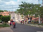
 Avenida Newton Belo in Santa Luzia
|
|||
|
|||
| Coordinates | 4 ° 4 ′ S , 45 ° 41 ′ W | ||
 Location of the municipality in the state of Maranhão Location of the municipality in the state of Maranhão
|
|||
| Symbols | |||
|
|||
| founding | March 26, 1961 (town charter) (age 59) | ||
| Basic data | |||
| Country | Brazil | ||
| State | Maranhão | ||
| ISO 3166-2 | BR-MA | ||
| height | 60 m | ||
| climate | tropical, Aw | ||
| surface | 4837 km² | ||
| Residents | 74,043 (2010) | ||
| density | 15.3 Ew. / km² | ||
| estimate | 72,667 (July 1, 2019) | ||
| Parish code | IBGE : 2110005 | ||
| Post Code | 65390-000 | ||
| Telephone code | (+55) 98 | ||
| Time zone | UTC −3 | ||
| Website | santaluzia.ma (Brazilian Portuguese) | ||
| politics | |||
| City Prefect | Francilene Paixão de Queiroz (2017–2020) | ||
| Political party | PP | ||
| economy | |||
| GDP | 560,020 thousand R $ 7851 R $ per person (2016) |
||
| HDI | 0.550 (low) (2010) | ||


Santa Luzia , officially Portuguese Município de Santa Luzia , is a municipality in the Brazilian state of Maranhão . The population was estimated on July 1, 2019 at 72,667 inhabitants, who live on a municipality area of around 4837 km² and are called Santa-Luzienser ( santa-luzienses ). The calculated population density is 13.5 people per km². It ranks 14th out of 217 municipalities in the state. The capital São Luís is 294 km away, connected by the BR-222 and BR-135 .
A small part of the community area (0.88%) is part of the Araribóia indigenous reserve , in which Guajajáras live.
geography
Surrounding communities are Santa Inês , Arame , Tufilândia , Buriticupu , Brejo de Areia , Altamira do Maranhão , Paulo Ramos , Marajá do Sena , Altamira do Maranhão, Alto Alegre do Pindaré and Amarante do Maranhão .
The community has a tropical climate, Aw according to the Köppen and Geiger climate classification . The average temperature is 27.2 ° C. The average rainfall is 1688 mm per year. In the southern summer, Santa Luzia has more rainfall than in the southern winter.
Population development
| year | Residents | city | country |
|---|---|---|---|
| 1991 | 57,661 | 17,967 | 39,694 |
| 2000 | 67,648 | 21,264 | 46,384 |
| 2010 | 74,043 | 25,789 | 48,254 |
| 2019 | 72,667 | ? | ? |
 |
|||
Source: IBGE (2011)
Ethnic composition
Ethnic groups according to the statistical classification of the IBGE (status 2000 with 69,271 inhabitants, status 2010 with 74,043 inhabitants): Of these, 25,789 inhabitants lived in urban areas in 2010 and 48,254 in rural areas.
| group | Share 2000 |
Share 2010 |
annotation |
|---|---|---|---|
| Brancos | 18,669 | 13,899 | Whites, descendants of Europeans |
| Pardos | 39,809 | 52,939 | Mixed races, mulattos , mestizos |
| Pretus | 9,912 | 6.262 | black |
| Amarelos | 136 | 821 | Asians |
| Indigenous people | 125 | 122 | indigenous population |
| without specification | 620 | - |
Images from Santa Luzia
Rural road in Santa Luzia

Igreja Santa Luzia

Bus station in Santa Luzia


Web links
- City Prefecture website , Prefeitura Municipal (Brazilian Portuguese)
- City Council website , Câmara Municipal (Brazilian Portuguese)
Individual evidence
- ↑ a b c Santa Luzia - Panorama. In: cidades.ibge.gov.br. IBGE , accessed November 15, 2019 (Brazilian Portuguese).
- ↑ França do Macaquinho 11 (Prefeita). In: todapolitica.com. Eleições 2016, accessed November 15, 2019 (Brazilian Portuguese).
- ↑ Santa Luzia climate: average temperature, weather by month, Santa Luzia weather averages - Climate-Data.org. In: de.climate-data.org. Retrieved November 15, 2019 .
- ^ Atlas do Desenvolvimento no Brasil: Santa Luzia, MA . Retrieved November 15, 2019 (Brazilian Portuguese)
- ↑ IBGE : Sistema IBGE de Recuperação Automática - SIDRA: Tabela 2093. Retrieved on November 15, 2019 (Portuguese, database query, search terms Santa Inês (MA) and Cor ou raça).