Sarstein
| Sarstein | ||
|---|---|---|
|
Bad Goisern view of the Sarstein |
||
| height | 1975 m above sea level A. | |
| location | Upper Austria and Styria , Austria | |
| Mountains | Dachstein Mountains | |
| Dominance | 8.1 km → Krippenstein | |
| Notch height | 1084 m ↓ Blaa-Alm-Sattel | |
| Coordinates | 47 ° 36 '7 " N , 13 ° 41' 54" E | |
|
|
||
| rock | Dachstein Limestone | |
| Age of the rock | Norium - Rhaetium | |
| Normal way | Rotengraben (not difficult ) | |

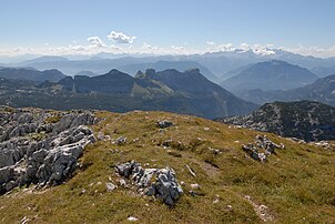
The Sarstein is an isolated mountain of the Dachstein Mountains in the Salzkammergut . It culminates in 1975 m above sea level. A. High High Sarstein and the boundary between forms Upper Austria and the Styrian Ausseerland .
location
The Sarstein is enclosed on the west side by Lake Hallstatt . On the north side is the Pötschenpass , east of the Sarstein lies the Koppental and in the south the town of Obertraun . The Sarstein massif is separated from the Dachstein massif by the valley of the Traun . But it consists mainly of Dachstein limestone and represents a broken clod of the Dachstein stock.
The Sarstein includes the peaks of the Hohe and Niedere Sarstein ( 1877 m ) as well as the Schwarzkogel ( 1800 m ), the Gröbkogel ( 1724 m ) and the Feuerkogel ( 1704 m ). On the south ridge of the Sarstein lies the Sarsteinhütte der Naturfreunde at 1620 m , on the north side the private Sarsteinalm ( 1711 m ).
Surname
The name Sarstein comes from an older Scharstein or Schorrstein and is derived from Middle High German schorre and Old High German scorro , ' schroffer Fels'. The sound change "r" before consonant to "ch" is a local dialect where the name Sochstoan is spoken (and is found analogously to Dachstein , dialectal Dochstoan ).
Ascent
- Pötschenpasshöhe ( 993 m ) - Sarsteinalm ( 1711 m ) - Hoher Sarstein ( 1975 m ): walking time around 3 hours
- Pötschenkehre ( 745 m ) - Simony view - Rotengraben - Sarsteinalm - Hoher Sarstein: walking time around 4 hours
- From Obertraun ( 513 m ) through the Brettsteingraben to the Sarsteinhütte and from there over the south ridge to the summit: walking time around 5 hours.
Literature and maps
- Wolfgang Heitzmann: Salzkammergut with the Totem Mountains and Dachstein: high-altitude trails, summit tours, via ferratas. New edition Bruckmann Verlag, Munich 2002, ISBN 3-7654-3336-5 , Tour No. 43, pp. 170-173.
- ÖK 50, sheet 96 (Bad Ischl), 1: 50,000.
Web links
- Sarsteinalm website (many photos)
- Sarsteinhütte
Individual evidence
- ↑ Ulrike Pistotnik: Facies and tectonics of the Hallstatt Zone from Bad Ischl - Bad Aussee (Salzkammergut, Austria). In: Communications from the Geological Society in Vienna 66. – 67. Volume, 1973/74, p. 14 uibk.ac.at (PDF).
- ↑ Margareta Rada: The settlement names of the Salzkammergut in Upper Austria and Styria. Univ. Diss., Vienna 1955, p. 307.
- ^ Peter Wiesinger: Place names and settlement history in the Salzkammergut. In: Yearbook of the Upper Austrian Museum Association. Volume 149, 1, Linz 2004, p. 556, whole article p. 543-560 ( PDF (2.3 MB) on ZOBODAT , p. 14 there).


