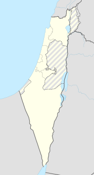
Savjon
| Savjon | ||
|---|---|---|
| Basic data | ||
| hebrew : | סַבְיוֹן | |
| State : |
|
|
| District : | Central | |
| Founded : | 1951 | |
| Coordinates : | 32 ° 3 ' N , 34 ° 53' E | |
| Height : | 56 m | |
| Area : | 3.746 km² | |
| Residents : | 3968 (as of: 2018) | |
| Population density : | 1,059 inhabitants per km² | |
| Community code : | 0587 | |
| Time zone : | UTC + 2 | |
| Community type: | Local government | |
|
|
||
Savjon ( Hebrew סַבְיוֹן) is a municipal administration in the central district of Israel with 3968 inhabitants (2018) on an area of 3.75 km².
Location and surroundings
Savjon is located between Petach Tikwa , Kirjat Ono and Yehud in Israel . In December 2009, 3,000 people lived in Savjon.
history
Savjon was founded in 1955 for elderly immigrants from South Africa. Today younger residents live in the village. In 2004, the moshav Ganei Jehuda ( Hebrew גַּנֵּי יְהוּדָה) incorporated into Savjon.
Name and coat of arms
Savjon was named after a wild flower ( ragweed ). The first part of the name (Sav) also means "grandfather", which was appropriate for the inhabitants at the time.
Population development
| year | 2009 | 2012 | 2016 |
| Residents | 3,000 | 3,343 | 3,787 |
Known residents
- Gilad Erdan (* 1970), politician
- Dan Nave (* 1960), politician
- Gideon Patt (born 1933), politician
- Ja'ir Shamir (* 1945), politician
- Michael Tschernoji , also Michael Cherney , Mikhail Chernoy , Mikhail Chorny or Mikhail Chernoi (born January 16, 1952) ( Hebrew מיכאל צ'רנוי; Russian Михаил Чёрный ), Israeli entrepreneur and industrialist, founder of the Michael Cherney Foundation .
- Dan Margalit (* 1938) ( Hebrew דן מרגלית), Journalist, author and television host
- David Mor , father-in-law of Amos Mansdorf
- Mody Kidon
- Moshe Arens (1925–2019), politician and flight engineer
gallery
Web links
Commons : Savjon - collection of images, videos and audio files
Individual evidence
- ↑ אוכלוסייה ביישובים 2018 (population of the settlements 2018). (XLSX; 0.13 MB) Israel Central Bureau of Statistics , August 25, 2019, accessed May 11, 2020 .
- ↑ Table 3 - Population of Localities Numbering Above 2,000 Residents and Other Rural Population . Israel Central Bureau of Statistics . June 30, 2010. Retrieved October 30, 2010.
- ↑ Vilnai, Ze'ev (1978). "Savyon". Ariel Encyclopedia. Volume 5. Israel: Am Oved. Pp. 5298-99. (Hebrew)
- ↑ Meg Laughlin, "Intelligence conference draws criticism," St. Petersburg Times (March 6, 2007) p. 1A.


