
Schellbach (Gutenborn)
|
Schellbach
Community Gutenborn
Coordinates: 50 ° 58 ′ 38 ″ N , 12 ° 7 ′ 3 ″ E
|
|
|---|---|
| Height : | 269 m |
| Area : | 10.39 km² |
| Residents : | 492 (December 31, 2008) |
| Population density : | 47 inhabitants / km² |
| Incorporation : | January 1, 2010 |
| Postal code : | 06712 |
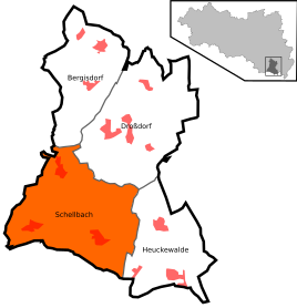  Location of Schellbach in Gutenborn
|
|
Schellbach is a district of the community of Gutenborn and is located in the southeast of the Saxony-Anhalt Burgenland district .
,_view_to_Schellbach_and_Lonzig.jpg)
history
The former community consisted of the districts Lonzig , Ossig (both places were incorporated on July 1, 1950) and Schellbach.
Since January 1, 2010, Schellbach and its districts, as well as Bergisdorf , Droßdorf and Heuckewalde with their respective districts, belong to the community of Gutenborn . Since then this has belonged to the Droyßiger-Zeitzer Forest Association .
Development of the population (from 1995 on each December 31st) :
|
|
- Data source: State Statistical Office Saxony-Anhalt
Sights and cultural monuments
- Numerous four-sided farms that are listed as historical monuments are spread across the municipality .
- The church in the Ossig district is a single-nave Romanesque building with a choir tower . The sacred building, documented for the first time in 1489, has a subsequently added choir polygon with heavily structured buttresses and is now a listed building.
- War memorial in the cemetery
Economy and Infrastructure
The eastern municipal border is affected by the federal highway 2 .
Web links
Commons : Schellbach (Gutenborn) - Collection of images, videos and audio files
Individual evidence
- ↑ Gutenborn community. Retrieved July 21, 2017 .
- ↑ StBA: Area changes from January 01 to December 31, 2010
- ↑ State Office for the Preservation of Monuments in Saxony-Anhalt: List of monuments in Saxony-Anhalt. Burgenland district (II). Michael Imhof Verlag, Petersberg 2003, ISBN 3-935590-57-1 .