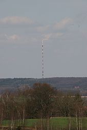
Tow tractor harrow
| Tow tractor harrow | ||
|---|---|---|
|
The Schleptruper Harrow |
||
| height | 148 m above sea level NHN | |
| location | Bramsche | |
| Mountains | Wiehengebirge | |
| Coordinates | 52 ° 22 '27 " N , 8 ° 1' 52" E | |
|
|
||
| particularities | Broadcasting station Schleptruper Egge | |
The Schleptruper Egge is a 148 m high elevation in the Bramsch district of Schleptrup as part of the Wiehengebirge . In the north there is the Great Moor at an altitude of about 47 m above sea level. NHN , the Mittelland Canal built in the early 20th century and the Bramsch district of Kalkriese . Federal motorway 1 , known as the Hansalinie, runs immediately to the east of the Schleptruper Egge .
At the top of the mast of the Schleptruper Egge is NDR - transmitter Osnabrück Engter . The long-distance hiking trail Hünenweg of the Wiehengebirgsverband Weser-Ems , which leads from Osnabrück to Papenburg , also runs over the Schleptruper Egge .
Web links

The landmark of the Schleptruper Egge is the 230 meter high mast of the NDR - transmitter Osnabrück Engter
Commons : Schleptruper Egge - Collection of images, videos and audio files

