Schmelzbach (victory)
| Schmelzbach | ||
|
|
||
| Data | ||
| Water code | DE : 272592 | |
| location | North Rhine-Westphalia , Germany | |
| River system | Rhine | |
| Drain over | Victory → Rhine → North Sea | |
| source | In the Nutscheid 50 ° 48 ′ 35 ″ N , 7 ° 26 ′ 2 ″ E |
|
| Source height | 258 m above sea level NN | |
| muzzle | When melting in the Sieg coordinates: 50 ° 46 ′ 49 ″ N , 7 ° 26 ′ 1 ″ E 50 ° 46 ′ 49 ″ N , 7 ° 26 ′ 1 ″ E |
|
| Mouth height | 86 m above sea level NN | |
| Height difference | 172 m | |
| Bottom slope | 38 ‰ | |
| length | 4.5 km | |
| Catchment area | 8.279 km² | |
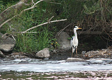
The Schmelzbach is a brook in the municipality of Eitorf . It rises in the Nutscheid and flows into the Sieg at Schmelze . Before the district of Schmelze was formed, the brook was called Hombach . The districts belong to its catchment area
- Wilkomsfeld
- Slander
- Mischief
- Schellbruch , which, as the remote Baumhof directly on the Roman road is
- Hönscheid , a chapel town
and today Ruppichteroth belonging Schneppe .
The largest inflow is the Überbuschbach, which flows into Hatzfeld .
