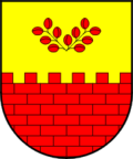
Miren-Kostanjevica
| Miren-Kostanjevica | |||
|
|||
| Basic data | |||
|---|---|---|---|
| Country |
|
||
| Historic region | Coastal land / Primorska | ||
| Statistical region | Goriška (Gorica) | ||
| Coordinates | 45 ° 54 ' N , 13 ° 36' E | ||
| surface | 62.8 km² | ||
| Residents | 4,895 (2008) | ||
| Population density | 78 inhabitants per km² | ||
| Post Code | 5291 | ||
| License Plate | GO | ||
| Structure and administration | |||
| Mayor : | Zlatko Martin Marušič | ||
| Website | |||
Miren-Kostanjevica (Italian: Merna-Castagnevizza , German: Schmitt-Kästenholz ) is a municipality in the Primorska region in Slovenia .
The total community, consisting of 15 villages and hamlets, has 4895 inhabitants and is located near Nova Gorica on the border with Italy . The administrative center is the village of Miren. The municipality is located in the karst area of the Vipava Valley (Vipavska dolina).
Interesting tourist destinations are the Miren Castle from the 13th century, the highest point, the Trstelj with 643 m and the many caves in the Karst.
Districts
- Bilje (German: Billiach)
- Hudi Log (German: Teufelswald)
- Korita na Krasu (German: Korith im Karst)
- Kostanjevica na Krasu, (German: Kästenholz)
- Lipa (German: Lippa)
- Lokvica (German: Lokwitz)
- Miren (German: Schmitt)
- Nova vas (German: Neudorf im Karst)
- Novelo (German: Neuhausl)
- Opatje selo (German: Abtsdorf)
- Orehovlje (German: Orechelach)
- Sela na Krasu (German: Sellen im Karst)
- Temnica (German: Tomensdorf)
- Vojščica (German: Voitsberg)
- Vrtoče (German: Vertatz)

