Black louder
| Black louder | ||
|
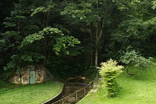
The Schwarze Lauter at the Lautermühle in Schlattstall downstream |
||
| Data | ||
| location | Baden-Wuerttemberg , Germany | |
| River system | Rhine | |
| Drain over | Louder → Neckar → Rhine → North Sea | |
| source | in Schlattstall , part of the municipality of Lenningen 48 ° 31 ′ 27 ″ N , 9 ° 29 ′ 23 ″ E |
|
| Source height | approx. 535 m above sea level NN | |
| confluence | with the Weißer Lauter to the Lauter coordinates: 48 ° 32 ′ 19 ″ N , 9 ° 29 ′ 28 ″ E 48 ° 32 ′ 19 ″ N , 9 ° 29 ′ 28 ″ E |
|
| Mouth height | approx. 470 m above sea level NN | |
| Height difference | approx. 65 m | |
| Bottom slope | approx. 33 ‰ | |
| length | approx. 2 km | |
The Schwarze Lauter is the left source river of the Lenninger Lauter . It rises in Schlattstall from the Lauterquelle and the Goldloch . At Lenningen it merges with the White Lauter to form the Lauter.
swell
In the valley "Kohlhau", at the confluence of which into the valley of the Lenninger Lauter lies the place Schlattstall (today part of the municipality Lenningen), there are a total of six karst springs .
The amount of their water fro important both under nature conservation standing sources are:
Lauterquelle

The origin of the Black Lauter ( 48 ° 31 '27 " N , 9 ° 29' 23" O ) 20 m in front of the Lauter mill which emerges directly on the water-impermeable, wondering valley floor. This spring is so strong and abundant that its water was once able to drive the overshot mill wheel of the Lautermühle.
Schlattstaller Goldloch
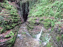
This now only periodically active water cave ( 48 ° 31 '25 ″ N , 9 ° 29 ′ 28 ″ E ) is located about 100 m east of the other source. The bulk fluctuates between 200 and 3,000 liters per second. The mouth of this cave was expanded to its present size by gold diggers in 1824/25 . The gold prospect was unsuccessful. Numerous other springs emerge on a slope next to the water cave after heavy rain events . After a few meters in Schlattstall, the Quellbach joins the one from the Lauterquelle. The gold hole is registered as a geotope under the name Goldloch at Schlattstall E von Grabenstetten .
The springs, the narrow valley and the small settlement are popular hiking destinations.
Around the end of 2015, a stone slab broke from the ceiling of the gold hole and is now blocking the entrance, there is a risk of collapse.
Trout farming
Farmed trout were kept in the clean, oxygen-rich karst spring water. The water from the springs north of the gold hole reaches the fish ponds on the eastern edge of Schlattstall.
Tributaries
- Seltenbach ( left )
See also
Web links
- Sources of the black volume
- The Swabian Alb and its nature: Sources: Goldloch. Retrieved May 29, 2010
Individual evidence
- ↑ Swabian Alb Cave Guide, H. Binder, H. Jantschke. 7th edition, Leinfelden-Echterdingen 2003
- ↑ Geotope profile on the map server of the State Office for Geology, Raw Materials and Mining (LGRB) (download link)

