Sema pass
| Sema pass | |||
|---|---|---|---|
|
|
|||
| Compass direction | south | North | |
| Pass height | 1894 m | ||
| region | Altai Republic ( Russia ) | ||
| Watershed | → Ursul → Katun | Sema → Katun | |
| Valley locations | Ongudai | Schebalino | |
| expansion | Trunk road R256 | ||
| Mountains | Sema Comb ( Altai ) | ||
| map | |||
|
|
|||
| Coordinates | 51 ° 2 '43 " N , 85 ° 36' 15" E | ||
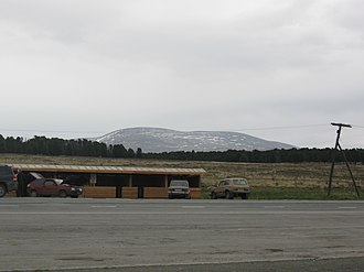
The Sema Pass ( Russian Семи́нский перевал , transcribed Seminski perewal, hence the Seminsky Pass ) is the most important road connection from Western Siberia to the mountainous region of the Russian Altai . The surrounding mountain range running in an east-west direction is called the Sema-Kamm . The name of the pass and the mountain range goes back to the Katun tributary Sema .
The pass is accessed from the trunk road R256 ( Tschuiski trakt, formerly M52) and is 1800 m above sea level . The nearest larger town is Schebalino, 30 km to the north, on a tributary of the Katun , whose breakthrough valley in the foothills is too narrow for an expressway.
In the further course, the southern ramp of the pass road leads through the regional capital Ongudai back down into the main valley of the Katun and reaches it after about 100 km at the village Inja .
literature
- Marina Tankowa et al .: Altai. Puteschestwije po Tschuiskomu traktu: putewoditel . Pjat pljus, Barnaul 2006, p. 129 ff. ISBN 978-5-9900731-1-1 . (Russian)

