Ongudai
| Village
Ongudai
Онгудай
|
||||||||||||||||||||||||||
|
||||||||||||||||||||||||||
|
||||||||||||||||||||||||||
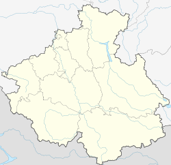
Ongudai ( Russian Онгуда́й ) is a larger village ( selo ) in the Autonomous Republic of Altai (southwestern Siberia , Russia ) with 5655 inhabitants (as of October 14, 2010).
geography
The place is about 130 km south of the republic capital Gorno-Altaisk and like this in the catchment area of the left and largest Ob -Quell river Katun , on its left tributary Ursul . To the northeast of Ongudai, the Altai mountains between Ursul and Katun reach heights of a good 1900 m and are forested up to the summit. To the southwest, the foothills of the Terekta ridge rise at around 2500 m above the tree line .
Ongudai is the administrative center of the Ongudai Rajon of the same name .
- Population development
| year | Residents |
|---|---|
| 1939 | 3230 |
| 1959 | 3328 |
| 1970 | 3737 |
| 1979 | 4472 |
| 1989 | 5399 |
| 2002 | 5376 |
| 2010 | 5655 |
Note: census data
Infrastructure
Ongudai is located on the R256 trunk road that goes south from Novosibirsk and Gorno-Altaisk to the Russian Altai . The almost 1900 m high Sema Pass , over which it crosses the watershed between the Katun tributaries Sema and Ursul, is located about 50 km northwest of the village.
Web links
Individual evidence
- ↑ a b Itogi Vserossijskoj perepisi naselenija 2010 goda. Tom 1. Čislennostʹ i razmeščenie naselenija (Results of the All-Russian Census 2010. Volume 1. Number and distribution of the population). Tables 5 , pp. 12-209; 11 , pp. 312–979 (download from the website of the Federal Service for State Statistics of the Russian Federation)


