Maima
| Village
Maima
Майма
|
||||||||||||||||||||||||||||||||||
|
||||||||||||||||||||||||||||||||||
|
||||||||||||||||||||||||||||||||||
| List of large settlements in Russia | ||||||||||||||||||||||||||||||||||
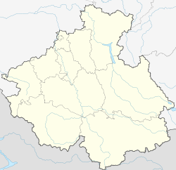
Maima ( Russian Майма ) is a large village in the north of the Autonomous Republic of Altai (southwestern Siberia , Russia ) with 16,174 inhabitants (as of October 14, 2010) and a built-up area of almost 10 km² (as of 2009).
geography
The town lies on the northern edge of the Altai Mountains , on the eastern bank of whether -Quellflusses Katun , which already here meander starts. It is surrounded by mountains that are still a good 600 meters high, which slowly merge into hill country to the north . The Maima river of the same name , coming from Gorno-Altaisk, flows into the Katun on the right.
Maima has an area of almost 10 km² and is now practically a suburb of the republic capital Gorno-Altaisk , into which it merges seamlessly in the southeast. The distance between the town centers is almost ten kilometers.
The place is the administrative center of the Raion of the same name ( Altaisch Aimak) Maima and forms the rural settlement Maima ( Майминское сельское поселение ), to which besides Maima also the villages Dubrowka, Karluschka, Podgornoje and Rybalka belong. The Maima Rajon completely surrounds the city of Gorno-Altaysk.
The main traffic connection is the M52 trunk road , which runs on the eastern edge of Maimas on the edge of the foothills. This Chuja tract connects Siberia with the high mountains of the Altai and western Mongolia and is the main access route for mountaineers, trekking and canyoning enthusiasts. There is an airport used for local connections near the town . A railway connection to Biysk , 100 km away, is being planned.
history
Maima was founded by Russian resettlers in 1810 or 1811 and named after the river, the name of which can be traced back to the name of the historical Altai family association of the "Maimanen". In 1830 the Russian Orthodox missionary Makari Glucharew came to Maima for the first time and in 1834 founded a missionary station there to work among the shamanistic and Buddhist Altai people. At that time there were more than ten Russian farmhouses and shops of the Russian traders Shebalin and Shuravlyov in the place.
In 1924 the Rajon or Aimak Maima was founded, the administrative center of which was in the neighboring village of Ulala, today's city of Gorno-Altaysk. In 1938 the latter (at that time under the name Oirot-Tura) was spun off from the Rajon and the administration was transferred to the village of Maima.
Population development
| year | Residents |
|---|---|
| 1959 | 4,598 |
| 1970 | 7,573 |
| 1979 | 9,508 |
| 1989 | 12,856 |
| 2002 | 15,344 |
| 2010 | 16,174 |
Note: census data
Culture and sights
In Maima there is a geological museum Kamni Altaja ("Stones of the Altai") , in which minerals, fossils and worked gemstones from the Altai are exhibited.
Economy and Infrastructure
In Maima, smaller forestry, agricultural and construction businesses and those for road transport are located. Geological and geophysical companies have their base camps here.
Maima is located on the M52 trunk road , which runs from Novosibirsk through the Altai region and the Altai Republic - here called Chujatrakt - to the Mongolian border near Taschanta , from which the road to nearby Gorno-Altaisk and further to the eastern part of the republic on the upper reaches of the Bija and Lake Teletsk branches off. The extension of the Novoaltaysk - Biysk railway line by a good 100 kilometers to Gorno-Altaysk, which would also touch Maima, is under discussion.
The regional airport of Gorno-Altaisk ( ICAO code UNBG ) is located a few kilometers southwest of the town between M52 and Katun .
Individual evidence
- ↑ a b Itogi Vserossijskoj perepisi naselenija 2010 goda. Tom 1. Čislennostʹ i razmeščenie naselenija (Results of the All-Russian Census 2010. Volume 1. Number and distribution of the population). Tables 5 , pp. 12-209; 11 , pp. 312–979 (download from the website of the Federal Service for State Statistics of the Russian Federation)
- ↑ Administrative structure ( memento of the original from October 18, 2012 on WebCite ) Info: The archive link was inserted automatically and has not yet been checked. Please check the original and archive link according to the instructions and then remove this notice. of the Altai Republic on its official Internet portal, with information on individual Rajons and places (Russian)
- ↑ Maima on the RussiaOutdoors website (Russian)
- ↑ Report in the newspaper of the Russian Railways Gudok , January 27, 2001 (Russian)

