Ust-Kan
| Village
Ust-Kan
Усть-Кан
|
||||||||||||||||||||||||||||
|
||||||||||||||||||||||||||||
|
||||||||||||||||||||||||||||
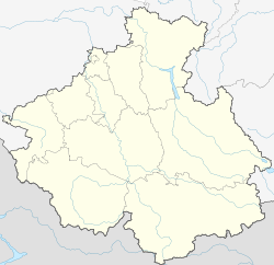
Ust-Kan ( Russian Усть-Кан , South Altai Кан-Оозы / Kan-Oosy ) is a village (selo) in the west of the Autonomous Republic of Altai in southern Siberia ( Russia ) with 4123 inhabitants (as of October 14, 2010).
geography
The place is not far from the border with Kazakhstan on the edge of an extensive steppe plateau between the over 2000 m high ridges Korgon and Bashchelak of the Russian Altai . At the village, the river flows Kan in the upper reaches of the left Whether -Nebenflusses Tscharysch .
Ust-Kan is the administrative center of Ust-Kan Rajon .
history
The village was founded in 1876.
- Population development
| year | Residents |
|---|---|
| 1939 | 1838 |
| 1959 | 2432 |
| 1970 | 2429 |
| 1979 | 2690 |
| 1989 | 3022 |
| 2002 | 3528 |
| 2010 | 4123 |
Note: census data
Attractions
Traces of settlement from the Paleolithic Age were found in caves near Ust-Kan . The 600,000 year old finds represent the oldest evidence of Stone Age man found in Siberia.
Infrastructure
The place is on the regional road R373 , which leads from Tuekta on the trunk road M52 ("Tschujatrakt") to Ust-Koksa and Tjungur on the upper reaches of the Katun . There is a bus connection to the republic capital Gorno-Altaisk via this . At Ust-Kan a shorter, but more difficult to drive road branches off through the northwest of the republic to Tscherga , also on the M52.
Individual evidence
- ↑ a b Itogi Vserossijskoj perepisi naselenija 2010 goda. Tom 1. Čislennostʹ i razmeščenie naselenija (Results of the All-Russian Census 2010. Volume 1. Number and distribution of the population). Tables 5 , pp. 12-209; 11 , pp. 312–979 (download from the website of the Federal Service for State Statistics of the Russian Federation)
swell
- Map of Central Asia , Brockhaus Atlas 1980


