Kyzyl-Osjok
| Village
Kyzyl -Osjok
Кызыл-Озёк
|
||||||||||||||||||||||||||||
|
||||||||||||||||||||||||||||
|
||||||||||||||||||||||||||||
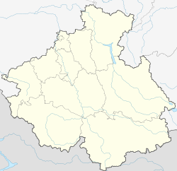
Kyzyl -Osjok ( Russian Кызыл-Озёк ) is a village (selo) in the Altai Republic ( Russia ) with 4052 inhabitants (as of October 14, 2010).
geography
The place is 8 km as the crow flies south of the center of the republic capital Gorno-Altaisk , to which it is almost immediately connected. It is located in the northern part of the Russian Altai mainly on the right bank of the Maima , a right tributary of the Katun .
Kyzyl-Osjok belongs to Rajon Maiminski and is located approximately 15 km south-southeast of the county seat Maima . It is the seat of the rural community Kyzyl-Osjokskoje selskoje posselenije, which includes the village of Kyzyl-Osjok, the villages of Karassuk and Sredny Saidys and the settlements of Alfjorovo, Verkhny Saidys and Ulalushka. Kyzyl-Osjok is (as of 2010) the largest village in the Altai Republic by population, which is not the administrative seat of a Rajon.
history
The village was established in 1922 to the existing since 1881 Russian Orthodox Ulala- Nicholas - Missions -Nonnenkloster ( Nicolaevsky Ulalinski missionerski schenski monastyr ; Ulala was the then name of today's Gorno-Altaisk), which was in turn emerged from a 1863 registered community of nuns. The monastery, which was closed and destroyed during the Soviet period, was one of the most important pilgrimage sites in the region at the beginning of the 20th century .
Kyzyl-Osjok grew as a residential suburb of the republic's capital, especially from the 1980s.
Population development
| year | Residents |
|---|---|
| 2002 | 3199 |
| 2010 | 4052 |
Note: census data
traffic
Kyzyl-Osjok is on the road which, coming from the M52 near Maima via Gorno-Altaysk, continues via Tschoja into the north-eastern part of the republic, where it reaches the regional road R375 south of Turochak , that of Biysk on the right, eastern side of the Biya up to the Telezker See .
Individual evidence
- ↑ a b Itogi Vserossijskoj perepisi naselenija 2010 goda. Tom 1. Čislennostʹ i razmeščenie naselenija (Results of the All-Russian Census 2010. Volume 1. Number and distribution of the population). Tables 5 , pp. 12-209; 11 , pp. 312–979 (download from the website of the Federal Service for State Statistics of the Russian Federation)

