Jakonur
| Village
Jakonur
Яконур
|
||||||||||||||||||||||||
|
||||||||||||||||||||||||
|
||||||||||||||||||||||||
Jakonur ( Russian Якону́р ) is a village (selo) in the Altai Republic ( Russia ) with 1661 inhabitants (as of October 14, 2010).
geography
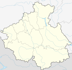
The place is about 130 km as the crow flies southwest of the republic capital Gorno-Altaisk in the northwestern part of the Russian Altai between the southeast end of the 2000 m high Bashchelakski ridge and the east running, there almost 1700 m high Anuiski ridge. The place is located on the left bank of the Kan , a right tributary of the Charysch .
Jakonur belongs to Rajon Ust-Kanski and is located about 15 km north-east of the administrative center of Ust-Kan . It is the seat and only locality of the rural municipality Jakonurskoje selskoje posselenije .
traffic
Jakonur is located on a road that branches off about 10 km south of Ust-Kan from the regional road R373 , which leads from Tuekta on the M52 trunk road (Tschuiski trakt) to Ust-Koksa and Tjungur on the upper reaches of the Katun . In a northerly direction, the road from Jakonur continues over the 1313 m high Keleiski Pass into the Anui valley and down towards Solonezhnoye in the neighboring Altai region .
Individual evidence
- ↑ a b Itogi Vserossijskoj perepisi naselenija 2010 goda. Tom 1. Čislennostʹ i razmeščenie naselenija (Results of the All-Russian Census 2010. Volume 1. Number and distribution of the population). Tables 5 , pp. 12-209; 11 , pp. 312–979 (download from the website of the Federal Service for State Statistics of the Russian Federation)

