Ulagan
| Village
Ulagan
Улаган
|
||||||||||||||||||||||||||||||
|
||||||||||||||||||||||||||||||
|
||||||||||||||||||||||||||||||
Ulagan ( Russian Улага́н ) is a village (selo) in the Altai Republic ( Russia ) with 3222 inhabitants (as of October 14, 2010).
geography
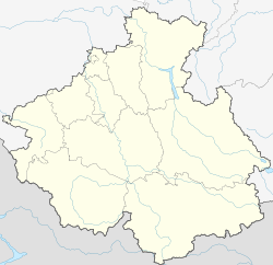
The place is about 200 km as the crow flies southeast of the republic capital Gorno-Altaisk in the Russian Altai . It is located at the mouth of the river Bolshoi Ulagan (Great Ulagan) in the Bashkaus , on its right bank.
Ulagan is the administrative seat of the Ulaganski Rajons and the seat and only locality of the rural municipality Ulaganskoje selskoje posselenije .
history
The village was founded in 1765 and in 1922, with the establishment of the Oirot Autonomous Oblast, from which the present Altai Republic emerged, the administrative seat of the Ulaganski aimak. In 1962/1963, as is common in other parts of the Soviet Union , this was converted into a Rajon . The village was called Ust-Ulagan at that time . In 1968 the administrative seat of the Rajon was relocated to the urban-type settlement of Aktasch (now a village), which had been founded a few years earlier, and back again in the 1980s. The current form of the name (without VAT ) has been official since the 1990s .
Population development
| year | Residents |
|---|---|
| 1939 | 1104 |
| 1959 | 1057 |
| 1989 | 2045 |
| 2002 | 2609 |
| 2010 | 3222 |
Note: census data
traffic
Ulagan is connected by a 50 km long road called Ulaganski trakt with the village of Aktasch on the M52 highway , which leads from Novosibirsk past Barnaul and Gorno-Altaisk to the Mongolian border at Taschanta . The Ulaganski trakt overcomes the 2080 m high Ulaganski pass about halfway . From Ulagan, roads lead east-southeast up the right bank of the Bashkaus to the village of Saratan, 25 km away, and up the Bolshoi Ulagan in a north-northeast direction to the village of Balyktujul, 15 km away, and since 1989 further into the Chulyshman valley and to the southern end of the Teletskoye. Lake .
Individual evidence
- ↑ a b Itogi Vserossijskoj perepisi naselenija 2010 goda. Tom 1. Čislennostʹ i razmeščenie naselenija (Results of the All-Russian Census 2010. Volume 1. Number and distribution of the population). Tables 5 , pp. 12-209; 11 , pp. 312–979 (download from the website of the Federal Service for State Statistics of the Russian Federation)


