Serio
| Serio | ||
|
Course of the Serio |
||
| Data | ||
| location | Italy , Lombardy | |
| River system | Po | |
| Drain over | Adda → Po → Adriatic Sea | |
| source | Passo del Serio 46 ° 5 ′ 2 ″ N , 10 ° 6 ′ 13 ″ E |
|
| muzzle | Montodine Coordinates: 45 ° 15 ′ 28 " N , 9 ° 41 ′ 38" E 45 ° 15 ′ 28 " N , 9 ° 41 ′ 38" E
|
|
| length | 124 km | |
| Catchment area | 1256 km² | |
| Discharge at the mouth of the A Eo : 1256 km² |
MQ Mq |
23 m³ / s 18.3 l / (s km²) |
| Left tributaries | Bondione, Ogna, Romna , Lujo | |
| Right tributaries | Goglio, Acqualina, Nossa, Albina, Carso, Luio, Nesa, Gardellone | |
|
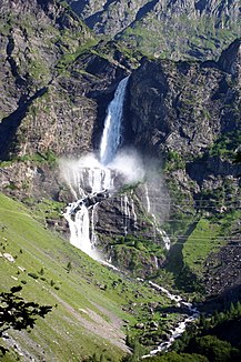
Cascate del Serio near Valbondione |
||
The Serio is a river in Lombardy , Italy . Its source is located at an altitude of 2,500 m on Passo del Serio between Monte Torena (2,911 m) and Pizzo del Diavolo della Malgina (2,926 m) near the municipality of Valbondione . The three-tiered waterfalls of the Serio there are considered the second highest in Italy. It crosses the provinces of Bergamo and Cremona , lies on its banks the airport Orio al Serio near the town of Bergamo and the city of Crema . South of Montodine it flows into the Adda , whose water reaches the Adriatic Sea via the Po .
Web links
Commons : Serio - album with pictures, videos and audio files

