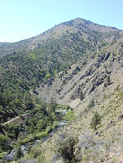
Shasta River
| Shasta River | ||
|
Course of the river in the catchment area of the Klamath River |
||
| Data | ||
| Water code | US : 267231 | |
| location | Siskiyou County in California (USA) | |
| River system | Klamath River | |
| Drain over | Klamath River → Pacific Ocean | |
| source | at the foot of the Eddy Mountains 21 km west of Mount Shasta 41 ° 21 ′ 0 ″ N , 122 ° 26 ′ 10 ″ W |
|
| Source height | approx. 1670 m | |
| muzzle |
Klamath River Coordinates: 41 ° 49 ′ 51 " N , 122 ° 35 ′ 39" W 41 ° 49 ′ 51 " N , 122 ° 35 ′ 39" W |
|
| Mouth height | 617 m | |
| Height difference | approx. 1053 m | |
| Bottom slope | approx. 13 ‰ | |
| length | 80 km | |
| Catchment area | 2053 km² | |
| Discharge at the Montague A Eo gauge : 1742 km² Location: 23 km above the mouth |
MQ 2002/2016 Mq 2002/2016 |
3.7 m³ / s 2.1 l / (s km²) |
| Discharge at the gauge Yreka A Eo : 2053 km² Location: 1 km above the mouth |
MQ 1934/2016 Mq 1934/2016 |
5 m³ / s 2.4 l / (s km²) |
| Left tributaries | Yreka Creek | |
| Right tributaries | Little Shasta River | |
| Reservoirs flowed through | Lake Shastina | |
| Small towns | Yreka | |
| Communities | Montague | |
|
View from the Pioneer Bridge on State Hwy. 263 on the Shasta River |
||
The Shasta River is a 80 km long left tributary of the Klamath River in the far north of the US state California . It drains an area of 2053 km².
course
The Shasta River rises at the foot of the Eddy Mountains 21 km west of Mount Shasta in Siskiyou County . At the upper reaches it is dammed up to the 12.8 km long Lake Shastina . The Shasta River flows in a northerly direction through a plateau north of Mount Shasta. The 38 km long Little Shasta River later flows from the right. The Shasta River then passes the town of Montague , located near the east bank . The city of Yreka is located west of the river. The Yreka Creek flows through the city and flows north of Yreka on the left into the Shasta River. This then cuts through the Klamath Mountains on its last 12 kilometers . The State Highway 263 follows the river. Eventually the Shasta River meets the Klamath River. The catchment area of the Shasta River lies in the rain shadow of the California Coast Mountains . Accordingly, the mean discharge at the mouth is only 5 m³ / s.
Ecosystem
In the Shasta River system, u. a. the following fish: silver salmon ( Oncorhynchus kisutch ), steelhead trout ( Oncorhynchus mykiss ) and king salmon ( Oncorhynchus tshawytscha ). In the past 80,000 king salmon returned to their spawning grounds in the Shasta River annually. To date, the number has decreased to a tenth. The stock of silver salmon is now vanishingly small.
Web links
Individual evidence
- ↑ a b Shasta River in the Geographic Names Information System of the United States Geological Survey
- ↑ a b USGS 11517500 SHASTA R NR YREKA CA
- ↑ USGS 11517000 SHASTA R NR MONTAGUE APPROX
- ↑ a b c d Shasta River . caltrout.org. Retrieved August 29, 2017.

