Siezbüttel
|
Siezbüttel
Schenefeld municipality
|
||
|---|---|---|
| Coordinates: 54 ° 3 ′ 9 ″ N , 9 ° 26 ′ 49 ″ E | ||
| Height : | 20 m above sea level NHN | |
| Area : | 4.08 km² | |
| Residents : | 68 (Jan 18, 2019) | |
| Population density : | 17 inhabitants / km² | |
| Incorporation : | January 1, 2013 | |
| Postal code : | 25560 | |
| Area code : | 04892 | |
|
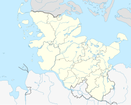
Location of Siezbüttel in Schleswig-Holstein |
||
Siezbüttel is a district of the community Schenefeld in the Steinburg district in Schleswig-Holstein . For the place name ending see -büttel . Until January 1, 2013 Siezbüttel was an independent municipality in the Schenefeld district .
Geography and traffic
Siezbüttel is located directly west of Schenefeld and about 14 km north of Itzehoe between the federal highway 23 and the green coastal road . The mill pond lies in the local area ; The Steenfurthsbach flows south of the village .
Based on the census of May 25, 1987, a population of 60 was extrapolated for the former municipality as of December 31, 2011. The 2011 census (reference date May 9, 2011) determined 64 inhabitants, which is also the value for the update to December 31, 2011 on the new basis.
coat of arms
Blazon : “Divided diagonally to the right by a broad silver bar into blue above and green below. A silver ox head placed on the front and red in the area of the silver bar. "
The village is on the historic Ochsenweg . The ox head and the silver bar running diagonally through the coat of arms refer to this. The mill pond, which previously served the mill and is now used as a bathing lake, is of particular importance . The blue should symbolize this water, which is important for the community. The green refers to the agriculturally used meadows and pastures that characterize the landscape around the community of Siezbüttel.


