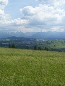
Koziniec ski area
The Koziniec ski area is located on the summit and the southwest slopes of the Wierchowina in the Polish mountain range Pogórze Spiskie in Czarna Góra in the municipality of Bukowina Tatrzańska in the powiat Tatrzański in the Lesser Poland Voivodeship . It is located outside the Tatra National Park at the foot of the High Tatras . The ski area is operated by the company Czarna Góra - Koziniec Sp. Z oo. It lies in the Polish Spiš . The ski area is a member of the TatrySki association , which issues a joint ski pass.
location
The ski area is located at an altitude of 833 m above sea level to 963 m above sea level. The difference in altitude between the slopes is approx. 130 m. There are two blue and one green slopes. The total length of the slopes is approx. 2.2 km, with the longest slope being approx. 1 km long.
history
The ski area was created in 2010.
description
Ski lifts
There is a chair lift and a pommel lift in the ski area. A total of up to 3080 people can be transported per hour.
Koziniec ski lifts
The ski lift leads from Czarna Góra to just below the summit of Wierchowina . There is also a button lift and three more button lifts, each approx. 450 m long, are being built.
| Surname | Art | Manufacturer | Broad people | Length (m) | Time (min) | Height difference (m) | People per hour | Upper station | Lower station | Vmax (m / s) |
||
|---|---|---|---|---|---|---|---|---|---|---|---|---|
| place | Height (m above sea level) | place | Height (m above sea level) | |||||||||
| A. | Chairlift | TATRAPOMA as | 4th | 650 | 6th | 130 | 2400 | Upper station | 963 | Lower station | 833 | |
| B. | Button lift | 1 | 300 | 58 | 680 | |||||||
Ski slopes
Three ski slopes lead from the Czarna Góra into the valley. Further slopes are currently being prepared.
| Surname | difficulty | begin | target | Length (m) | Height difference (m) | Tilt (%) | light | Artificial snow | FIS | Remarks | |||
|---|---|---|---|---|---|---|---|---|---|---|---|---|---|
| Surname | Height (m above sea level) | Surname | Height (m above sea level) | number | to | ||||||||
| 1 | blue - red | Upper station | 963 | Lower station | 833 | 900 | 130 | 19th | Yes | Yes | |||
| 2 | blue | Upper station | 963 | Lower station | 833 | 1000 | 130 | 13 | Yes | Yes | |||
| 3 | green | 300 | 58 | 19th | Yes | Yes | |||||||
Infrastructure
The ski area is located approx. 20 km northeast of the center of Zakopane and can be reached by car. A municipal road runs near the lower station. There are parking spaces, a snow park, a ski school, a ski rental and an approx. 4 km long cross-country ski run. There are also several restaurants in the ski area.
See also
- Bania ski area
- Kaniówka ski area
- Kotelnica ski area
- Rusiń-ski ski area
- Turnia ski area
- Grapa-Litwinka ski area
- Jurgów ski area
- List of ski resorts in Poland
Web links
- Homepage (Polish)
Coordinates: 49 ° 21 ′ 55 ″ N , 20 ° 8 ′ 6 ″ E

