Solovka
| Solovka | ||
| Соловка | ||

|
|
|
| Basic data | ||
|---|---|---|
| Oblast : | Zakarpattia Oblast | |
| Rajon : | Uzhhorod Raion | |
| Height : | 103 m | |
| Area : | 1.6155 km² | |
| Residents : | 825 (2006) | |
| Population density : | 511 inhabitants per km² | |
| Postcodes : | 89462 | |
| Area code : | +380 312 | |
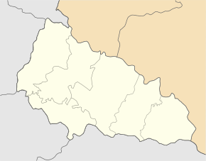
| Geographic location : | 48 ° 22 ′ N , 22 ° 16 ′ E | |
| KOATUU : | 2124885901 | |
| Administrative structure : | 2 villages | |
| Mayor : | Olexander Andrijowytsch Biro | |
| Address: | вул. Есенська 2 89462 с. Соловка |
|
| Statistical information | ||
|
|
||
Solowka ( Ukrainian and Russian Соловка ; Slovak Salok , Hungarian Szalóka ) is a village in the west of the Ukrainian Zakarpattia Oblast on the Hungarian border with about 800 inhabitants (2006).
The village, founded in 1464, is located on the banks of the Tisza in the south of Uzhhorod Rajon , about 36 km south of the Uzhhorod oblast center. The village is the center of the district council of the same name and has a border station to Hungary at a branch of the Lviv – Stryj – Chop railway line . The village of Petrivka ( Петрівка ⊙ ) with about 400 inhabitants also belongs to the district council .
Individual evidence
- ↑ Solovka on the official website of the Verkhovna Rada , accessed January 8, 2015

