Spůlka
|
Spůlka Sputka, Spůtka |
||
|
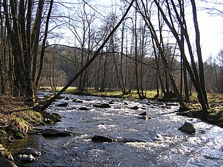
The Spůlka near Spůle |
||
| Data | ||
| Water code | CZ : 1-08-02-010 | |
| location | Czech Republic | |
| River system | Elbe | |
| Drain over | Volyňka → Otava → Vltava → Elbe → North Sea | |
| source | in the high moor Malý Polec near Zadov 49 ° 3 ′ 50 ″ N , 13 ° 37 ′ 7 ″ E |
|
| Source height | 1099 m nm | |
| muzzle | near Bohumilice in the Volyňka coordinates: 49 ° 5 ′ 56 " N , 13 ° 48 ′ 26" E 49 ° 5 ′ 56 " N , 13 ° 48 ′ 26" E |
|
| Mouth height | 548 m nm | |
| Height difference | 551 m | |
| Bottom slope | 29 ‰ | |
| length | 19.2 km | |
| Catchment area | 104.2 km² | |
| Drain |
MQ |
1 m³ / s |
The Spůlka , also known locally as Sputka or Spůtka , is a left tributary of the Volyňka in the Czech Republic .
course
The Spůlka rises at the southern foot of the Churáňovský vrch (1119 m) near the hamlet V Polci in the Malý Polec moor. The Přilba mountain rises south of the headwaters ( Helmit , 1219 m). The upper reaches of the brook leads via V Polci, Churáňov, Zadov, V Ráji, Lesní Chalupy, Pucherský Mlýn, Kůsov, Bláhov, Dolní Dvůr, Jirkalov, Sídliště and Stachy through the Šumava Biosphere Reserve to the northeast. The Spůlka then flows in the same direction past U Cajsů, Zdíkovec, Olší, Kudlata, Hodonín, Langův Mlýn, Čábuze, Čábuzské Chalupy and Vítovce. At its lower course, which runs along the places Mlýny, Žár, Putkov, Onšovice, U Narovců, Spůle and Na Drahách, the stream takes a south-easterly direction; to the left of the stream are the natural monuments U Narovců and Háje . After 19.2 kilometers, the Spůlka joins the Volyňka northwest of Bohumilice .
The mountain stream forms a partly rocky, natural meadow valley, and alluvial forest has been preserved on its banks .
Tributaries
- Stašský potok (r), Zadov
- Jáchymovský potok (l), near Stachy
- Zdíkovský potok (r), near Olší
- Horský potok (l), near Čábuze
- Mladíkovský potok (l), near Čábuzské Chalupy
- Košinský potok (r), at U Narovců
- Horosedelský potok (l), below Onšovice
