Bohumilice
| Bohumilice | ||||
|---|---|---|---|---|
|
||||
| Basic data | ||||
| State : |
|
|||
| Region : | Jihočeský kraj | |||
| District : | Prachatice | |||
| Area : | 342 ha | |||
| Geographic location : | 49 ° 6 ' N , 13 ° 49' E | |||
| Height: | 656 m nm | |||
| Residents : | 321 (Jan 1, 2019) | |||
| Postal code : | 384 81 | |||
| License plate : | C. | |||
| traffic | ||||
| Street: | Čkyně - Svatá Maří | |||
| Railway connection: | Strakonice – Volary | |||
| structure | ||||
| Status: | local community | |||
| Districts: | 1 | |||
| administration | ||||
| Mayor : | Jaroslav Nový (as of 2018) | |||
| Address: | Bohumilice 111 384 81 Čkyně |
|||
| Municipality number: | 550116 | |||
| Website : | bohumilice.cz | |||
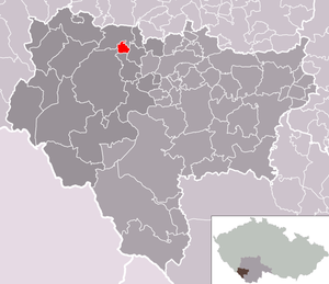
| Location of Bohumilice in the Prachatice district | ||||

|
||||
Bohumilice (German Bohumilitz , also Alt Skalitz ) is a municipality in the Czech Republic . It lies opposite the confluence of the Spůlka on the Volyňka and belongs to the Okres Prachatice . Bohumilice is located six kilometers northeast of Vimperk .
geography
Neighboring communities
| Čkyně | ||
| Vimperk |

|
Bošice |
| Svatá Maří |
history
The village was first mentioned in 1352. It has 314 residents and 62 companies. The place is a member of the Euregio Bavarian Forest - Bohemian Forest .
Attractions
- Skalice Castle
- Church of St. Trinity of God and St. Barbara
- chapel
Sons and daughters of the church
- Antonín Liška (1924–2003), Bishop of Budweis
Individual evidence
- ↑ http://www.uir.cz/obec/550116/Bohumilice
- ↑ Český statistický úřad - The population of the Czech municipalities as of January 1, 2019 (PDF; 0.8 MiB)
Web links
Commons : Bohumilice - collection of images, videos and audio files


