
Záblatí u Prachatic
| Záblatí | |||||
|---|---|---|---|---|---|
|
|||||
| Basic data | |||||
| State : |
|
||||
| Region : | Jihočeský kraj | ||||
| District : | Prachatice | ||||
| Area : | 2448 ha | ||||
| Geographic location : | 48 ° 59 ' N , 13 ° 57' E | ||||
| Height: | 593 m nm | ||||
| Residents : | 341 (Jan. 1, 2019) | ||||
| Postal code : | 383 01 - 384 33 | ||||
| License plate : | C. | ||||
| traffic | |||||
| Street: | Husinec - Zbytiny | ||||
| structure | |||||
| Status: | local community | ||||
| Districts: | 8th | ||||
| administration | |||||
| Mayor : | Vladislav Klabouch (as of 2018) | ||||
| Address: | Záblatí 9 384 33 Záblatí u Prachatic |
||||
| Municipality number: | 550680 | ||||
| Website : | www.obeczablati.cz | ||||
| Location of Záblatí in the Prachatice district | |||||

|
|||||


Záblatí (German Sablat ) is a municipality in the Czech Republic . It is located five kilometers southwest of Prachatice (Prachatitz) in the Bohemian Forest and belongs to the Okres Prachatice .
geography
location
The place is on the right bank of the Blanice (Flanitz) , at the deepest point of a wide basin, which is bordered in the west by the massif of the mountains Boubín (Kubany) and Bobík (Schreiner) and in the south and east by the foothills of the Libín . To the north, the terrain gradually rises to the heights of the Šumava foothills along the road from Vimperk (Winterberg) to Prachatice. At the entrance and exit of this basin, the Blanice flows through a narrow gorge. Immediately behind the entrance are the remains of the former Hus (goose) castle on a towering rock spur . These can be reached from Křišťanovice or the cemetery of the former village of Cudrovice (Zuderschlag) . At the end of this gorge there is a small nature reserve, in which the effects of the floods of 2002 on the course of the river as well as fauna and flora can be seen.
Community structure
The municipality Záblatí consists of the districts Albrechtovice (Albrecht beat) , Hlásná Lhota (Wihorschen) , Horní Záblatí (Obersablat) , Křišťanovice (Christel beat) , Řepešín (Repeschin) , Saladin (Soletin) , Záblatí (Sablat) and Zvěřenice (Wirschenitz) . Záblatí also includes the settlements Dobrá Voda (Gutwasser , also Bad Grindschädel) , Palas, Petrovice (Peterschlag) and Řepešínský Mlýn. Basic settlement units are Albrechtovice, Dobrá Voda, Hlásná Lhota, Horní Záblatí, Křišťanovice, Petrovice, Řepešín, Saladín, Záblatí and Zvěřenice.
The municipality is divided into the cadastral districts of Albrechtovice, Hlásná Lhota, Horní Záblatí, Křišťanovice u Záblatí, Petrovice u Záblatí, Řepešín, Saladín, Záblatí u Prachatic and Zvěřenice.
Neighboring communities
| Buk | Kratušín | Zábrdí |
.svg)
|
Prachatice | |
| Volary | Zbytiny |
history
The Sablat market was first mentioned in 1337, when King John of Luxembourg granted his Chamberlain Peter I. von Rosenberg the right to mine Sablat gold . Mainly that time gold was from the only slightly below the village in the Blanice (Flanitz) opens Cikánský Potok (Gypsy Stream) as " placer gold washed". In addition, and later exclusively, it was also mined. The torch and ax in the coat of arms still bear witness to this today. A final attempt to mine gold near the village of Wirschenitz ended after a short time again in 1820. A few years ago, the entrance to a tunnel of a medieval mine was discovered near the village of Albrechtschlag.
The place names Sablat, Obersablat, Repeschin, Soletin, Wirschenitz and Wihorschen are of Slavic origin. The higher-lying villages with the ending "schlag" - Peterschlag, Albrechtschlag, Christelschlag, Oberschlag and Schneiderschlag - mentioned in a somewhat more recent document in 1359 - were created later by German-speaking settlers from what is now Lower Bavaria and Upper Austria. They cleared the jungle on the heights to the south and west of the main town in order to be able to use the land obtained in this way for agriculture.
Sablat had its prime in the High Middle Ages. The Lord of the nearby Hus (goose) castle , his chamberlain Sigmund Huler von Orlik , granted the Bohemian King Wenceslaus on October 30, 1400 the right to fortify the "market" Sablat with towers, walls and moats. In addition, the place received city rights and permission to hold a weekly market. But far more profitable was so another the right to create "a newe strosze to ken Passaw" of Sablat from mule track parallel to the running already in the south of the castle Goose Golden Path , on which have long mule trains between Passau transported and Prachatitz goods . Part of the trade between Bohemia and Passau thus bypassed the city of Prachatitz from then on. Even after the devastating Hussite Wars, trade flourished again along this route. After a long process of litigation, the Prachatitz finally prevailed in 1524. From then on, the mules, who carried their merchandise on the oldest branch of the “Goldener Steiges” to Alt-Prachatitz and on the way back from this place, had to move through the town of Prachatitz again and pay their taxes there. Sablat lost its most important source of income and fell back on the importance of an agricultural town . As a result of the small farms, every citizen had to practice a craft or trade, such as stocking knitting or linen weaving . After all, the Sablater were able to save their market rights and freedom from robots over the period of feudalism . In contrast to the inhabitants of the surrounding villages, they were also subjects of the Rosenbergs and their successors, the Eggenbergs and finally the Schwarzenbergs ; But they alone and a few “free farmers ” in the surrounding villages and mills, who were also Sablat citizens, did not have to work free of charge for the manor on many days of the year. Presumably that was the reason for the pronounced civic pride that the Sablatians retained until they were expelled in 1946.
Over the centuries, Sablat has not been spared natural disasters, in particular floods, famines, wars and fires. In 1874 almost the whole place burned down, 56 houses were destroyed to the ground and 100 families were left homeless. According to the parish registers (from 1646) the area was anything but deserted after the Thirty Years War and therefore did not have to be repopulated by Germans. The famine at the beginning of the 1870s claimed many lives, especially among the numerous poor and house workers (small farmers and craftsmen). So the Sablat pastor sometimes had to bury three dead in a single day. During the Napoleonic period, Sablat suffered from frequent and long billeting of troops passing through. “Red cloaks”, or hussars , are said to have killed “all game in the woods”. The pastor Johann Adler recorded in detail in the "liber memorabilium", the parish chronicle. In the revolutionary year of 1848, a "national guard" was set up in Sablat, but it was only used for "parading".
In Sablat and the surrounding villages too, hardship and unemployment forced numerous young people to emigrate to America or to seek their fortune temporarily or permanently in the new industrial centers of the monarchy or in Saxony. Sablat was an emergency area during the First Republic . This circumstance and the increasing nationality dispute in the young Czechoslovakia also helped the Sudeten German Party to gain a majority here, especially in Sablat and in particular the surrounding German-speaking villages with the exception of civil servants and other state employees who had moved here and a few Czechs who had already resided here before the end of the First World War Census lists German has been the mother tongue of the vast majority of residents. After the Munich Agreement , Sablat became part of the German Empire . The border with the Protectorate of Bohemia and Moravia in the north was the border of the municipalities of Oberschlag, Repeschin, Sablat and Obersablat. After the surrender and while the US Army was still occupying the market and the surrounding villages, the first Czech "administrators" who were interested in a property came from neighboring Czech villages. After the expulsion of the Germans , which lasted until October 1946, Czech exiles and Slovaks from Ukraine and Romania later came to colonize the largely deserted villages. After the forced collectivization in 1950, they immediately lost their agricultural property again.
Modernity only began after the German-speaking population had been expelled, when Sablat and Obersablat were supplied with electricity in 1948. Wirschenitz finally followed in 1967. From 1990 onwards, many former Sablaters used the abolition of the visa requirement to visit their old homeland, especially for pilgrimages to Bad Grindschädel / Gutwasser. Busy life, as it was until the end of the Second World War and the expulsion of the German-speaking population in Sablat and the villages that were now incorporated, is not possible because the current number of inhabitants is only a fraction of the population at that time. While a total of 1731 people lived in Sablat and the villages that are now incorporated in 1939, at the beginning of 2014 there were only 354 people who live here all year round.
Attractions
- Parish Church of John the Baptist
- The Gothic parish church bears witness to the former wealth of the market . It is dedicated to John the Baptist . The presbytery and the sacristy are from the early Gothic period. The well-preserved frescoes in the sacristy, which is now used as a winter church, are particularly valuable in terms of art history . Since only the roof structure was destroyed by the great fire in 1874, the late-Gothic reticulated vault of the two-aisled nave remained undamaged. The original architecture is largely preserved. In the Baroque period , however, the south wall of the presbytery was broken through for the addition of the chapel consecrated to St. John of Nepomuk , in order to make room for the growing number of worshipers. During recent renovations, frescos have also been exposed on the north side of the nave. The main altar dates from 1910. Of the baroque side altars with their acanthus frames, the depiction of the Holy Family on the left side altar deserves special mention, which is attributed to the Prague baroque painter Peter Johann Brandl (1668–1735).
- Marterl and cemetery
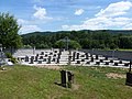
- Shortly before the cemetery on the left end of the village, next to the last residential building and in front of the former schoolhouse, there is a Marterl . There is an image of the Holy Trinity on its granite stele . In the cemetery itself there are still some cast iron crosses that rise above the preserved priestly graves. In August 2019, a memorial for the former German residents of the parish was inaugurated there, consisting of recovered tombstones and a granite cross, the trunk of which is split in length and is connected and stabilized by several steel elements.
- Pilgrimage Chapel Dobrá Voda (Gutwasser)

Parish church of John the Baptist in Záblatí

Frescoes in the nave of the parish church
Memorial in the cemetery in Záblatí

Memorial cross in the cemetery in Záblatí


Sons and daughters
- Johanna Mugrauer (1869–1940), Austrian singer
- Franz Stumpf (1876–1935), Austrian politician
- Walter Neuwirth (1935–2020), German religious and missionary
Other personalities
- Miloslav Vlk (1932–2017), retired Archbishop of Prague , was also responsible for the Záblatí parish during his work in Lažiště from 1971 to 1972
literature
- Böhmerwaldheimatkreis Prachatitz eV (Hrsg.): Heimatkreis Prachatitz in the Bohemian Forest. Ingolstadt 1970.
- Johann Trajer: Historical-statistical description of the Diocese of Budweis. Budweis 1862.
- Johann Gottfried Sommer : The Kingdom of Bohemia; Represented statistically and topographically. Eighth volume. Prachiner circle. JG Calve'sche Buchhandlung, Prague 1840, p. 353.
- Herbert Kieweg: Weasch'n, Wusch'n and Gulatsch'n - the parish of Sablat in history and stories. Lappersdorf 1994.
- Vaclav Stary: Záblatí 1337-1987. Z dejin obce Záblatí. Edited by Mistni Narodni Vybor v Záblatí (Czech).
Web links
- Archive materials on Záblatí in the digital archive of the State Regional Archives in Třeboň, accessed on November 22, 2015.
- Záblatí parish chronicles in the digital archive of the State Regional Archives in Třeboň, accessed on November 22, 2015.
Individual evidence
- ↑ http://www.uir.cz/obec/550680/Zablati
- ↑ Český statistický úřad - The population of the Czech municipalities as of January 1, 2019 (PDF; 0.8 MiB)
- ↑ http://www.uir.cz/casti-obce-obec/550680/Obec-Zablati
- ↑ http://www.uir.cz/zsj-obec/550680/Obec-Zablati
- ↑ http://www.uir.cz/katastralni-uzemi-obec/550680/Obec-Zablati
- ↑ Pictures from the inauguration of the memorial in the cemetery on August 31, 2019 ( Memento from November 26, 2019 in the Internet Archive )
- ^ Passauer Neue Presse: German-Czech reconciliation over the graves . August 26, 2019 ( digitized version [accessed November 25, 2019]).
- ↑ Herbert Kieweg: gift to help or stand at its beginning . In: Böhmerwaldheimatkreis Prachatitz eV (Hrsg.): The Böhmerwald Heimatbrief . No. 10 . Morsak Verlag, Grafenau 2019.
- ↑ Johann Trajer: Historical and statistical description of the diocese of Budweis. Budweis in 1862 , as a digital copy available in the digital collections of the Bavarian State Library , accessed November 22, 2015.
- ^ Johann Gottfried Sommer: The Kingdom of Bohemia presented statistically and topographically; 8. Volume Prachiner Circle. Prague 1840 , digitally available from the Internet Archive , accessed on November 22, 2015.