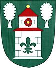
Chroboly
| Chroboly | ||||
|---|---|---|---|---|
|
||||
| Basic data | ||||
| State : |
|
|||
| Region : | Jihočeský kraj | |||
| District : | Prachatice | |||
| Area : | 3468 ha | |||
| Geographic location : | 48 ° 57 ' N , 14 ° 4' E | |||
| Height: | 758 m nm | |||
| Residents : | 552 (Jan. 1, 2019) | |||
| Postal code : | 383 01 - 384 04 | |||
| License plate : | C. | |||
| traffic | ||||
| Street: | Prachatice - Brloh | |||
| Railway connection: | Číčenice – Haidmühle | |||
| structure | ||||
| Status: | local community | |||
| Districts: | 7th | |||
| administration | ||||
| Mayor : | Oldřich Valouch (as of 2018) | |||
| Address: | Chroboly 91 384 04 Chroboly |
|||
| Municipality number: | 550264 | |||
| Website : | www.chroboly.cz | |||
| Location of Chroboly in the Prachatice district | ||||

|
||||
Chroboly (German Chrobold ) is a municipality in the Czech Republic . It is located eight kilometers southeast of Prachatice and belongs to the Okres Prachatice .
geography
location
Chroboly is located southeast of the Libín (1095 m) in the foothills of the Bohemian Forest . The Rohanovský vrch (1010 m) rises to the west. The village lies on a pass in the headwaters of the Živný potok and the Chrobolský potok. East lies the valley of Zlatý potok . On the western edge of the village, the line of the railway between Volary and Prachatice runs around the Libín , where Chroboly has a train station.
Neighboring places are Jelemek and Frantoly in the north, Klenovice, Mičovice and Jáma in the northeast, Příslop in the east, Záhoří and Ktiš in the southeast, Miletínky and Ovesné in the south, Koryto in the southwest, Podlesí, Skříněřov and Sviňovice in the west and Lučenice and Leptice in the north.
Community structure
The municipality of Chroboly consists of the districts Chroboly (Chrobold) , Leptač (Rohn) , Lučenice (Luzerier) , Ovesné (Harberles) , Příslop (Proslop) , Rohanov (Tonnetschlag) and Záhoří (Zaborsch) . Chroboly also includes the Doubrava ( Doberauer ), Jelení Hora ( Hirschenberg ), Planská (Planskus) and Podlesí ( Führnwald ) residential areas, as well as the Lažíš Schlagko (Schlag) desert . Basic settlement units are Chroboly, Lažíšťko, Leptač, Lučenice, Ovesné, Příslop, Rohanov and Záhoří.
The municipality is divided into the cadastral districts of Chroboly, Lažíšťko, Leptač, Ovesné, Příslop, Rohanov u Prachatic and Záhoří u Chrobol.
Neighboring communities
| Prachatice | Nebahovy | Mičovice |
| Zbytiny |

|
Lhenice |
| Křišťanov | Ktiš |
history
Chroboly was founded at the beginning of the 14th century by the Sancta Corona monastery in the Strobole forest . The village was first mentioned in a document in 1317. After the monastery was destroyed in 1420, Chroboly fell to the Rosenbergs and became part of the Krumlov domain .
On May 31, 1808, a major fire destroyed 14 farms. The rectory, the school and the church could still be saved from the attack of the flames. In 1946 the German Bohemian residents of Chrobolys were expelled .
Attractions
- Church of the Assumption of Mary, the Gothic building, which has been documented since 1360, was redesigned in Baroque style in 1754–58
- neo-Gothic pilgrimage chapel of the Virgin Mary of Lourdes, north of the village on the holy Brünnl in the forest, built 1902–1903, today a ruin
- Keplův mlýn watermill on Zlatý potok
- Red grates from Chroboly
Personalities
- Josef Dichtl (1910–1986), the dialect poet, worked as a pastor in Chrobold
- Eusebius Schenck (1569–1628), medic
Web links
Individual evidence
- ↑ http://www.uir.cz/obec/550264/Chroboly
- ↑ Český statistický úřad - The population of the Czech municipalities as of January 1, 2019 (PDF; 0.8 MiB)
- ↑ http://www.uir.cz/casti-obce-obec/550264/Obec-Chroboly
- ↑ http://www.uir.cz/zsj-obec/550264/Obec-Chroboly
- ↑ http://www.uir.cz/katastralni-uzemi-obec/550264/Obec-Chroboly

