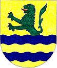
Zbytiny
| Zbytiny | ||||
|---|---|---|---|---|
|
||||
| Basic data | ||||
| State : |
|
|||
| Region : | Jihočeský kraj | |||
| District : | Prachatice | |||
| Area : | 3904 ha | |||
| Geographic location : | 48 ° 56 ' N , 13 ° 57' E | |||
| Height: | 786 m nm | |||
| Residents : | 318 (Jan. 1, 2019) | |||
| Postal code : | 383 01 - 384 41 | |||
| License plate : | C. | |||
| traffic | ||||
| Street: | České Budějovice - Volary | |||
| Railway connection: | Číčenice – Haidmühle | |||
| structure | ||||
| Status: | local community | |||
| Districts: | 6th | |||
| administration | ||||
| Mayor : | Josef Furiš (as of 2018) | |||
| Address: | Zbytiny 3 384 41 Zbytiny |
|||
| Municipality number: | 550701 | |||
| Website : | www.zbytiny.cz | |||
| Location of Zbytiny in the Prachatice district | ||||

|
||||
Zbytiny (German Oberhaid ) is a municipality in the Czech Republic . It is located eight kilometers south of Prachatice and belongs to the Okres Prachatice .
geography
location
Zbytiny lies on the right side of the Blanice in the valley of the Zbytinský potok in the Bohemian Forest foreland . The Libín (1095 m) rises to the northeast .
Neighboring towns are Sviňovice in the north, Skříněřov in the east, Koryto and Křišťanov in the southeast, Spálenec in the south, Svatá Magdaléna and Volary in the southwest, Můstek in the west and Blažejovice in the northwest.
Community structure
The municipality Zbytiny consists of the districts Blažejovice (Plahetschlag) , Koryto (Hundsnursch) , Skříněřov (Schreinetschlag) , Spálenec (burning mountain) , Sviňovice (Schweinetschlag) and Zbytiny (Oberhaid) and the living quarters Blanický Mlyn ( Flanitzmühle ) Ctyri Domy ( four houses ) , Dvojdomí ( two houses ), Mošna (Jandles) , Můstek (Bierbruck) , Sedmidomí ( seven houses ) and U Kalíšků. The Bemjegl ( Böhmjörgel ), Fritzovy domky ( Fritzhäuser ) and Rauscherova pila ( Rauschersäge ) deserts lie within the municipality .
The municipality is divided into the cadastral districts of Koryto, Skříněřov, Spálenec, Sviňovice and Zbytiny.
Neighboring communities
| Záblatí | Prachatice | |
| Volary |

|
Chroboly |
| Boletice | Křišťanov |
history
In the 14th century the Bohemian Forest area was settled around the present location and in 1388 it was first mentioned in a document as a Switin . In 1395 the Sancta Corona Monastery received the villages of Zbytiny, Blažejovice, Koryto, Skříněřov and Sviňovice. Five years later, in addition to the Czech name Zbytyny, there is also the German Hayd for the first time . After the monastery was destroyed by the Hussites in 1420, Zbytiny belonged to the monastery property that Ulrich II von Rosenberg appropriated.
The Rosenbergs held Zbytiny until the beginning of the 17th century . Due to high debt, Peter Wok von Rosenberg had to sell the property to Rudolf II . In 1600 Zbytiny consisted of 23 farmsteads, the Church of St. Catherine, a rectory and the Kretscham .
In 1622 Hans Ulrich received Zbytiny from Eggenberg . The German name Oberhait, which later became Oberhaid, has been in evidence since 1654. In the 17th century the parish in Oberhaid went out and the village was parish off to Wallern . When the male line of Eggenberg died out in 1717 , Oberhaid fell to the Schwarzenbergs . The church and 46 houses were destroyed in the fire of 1736. In 1786 the church in Oberhaid became a locality of Wallern, and in 1891 it was raised again to a parish church. The church was consecrated to St. Vitus.
After the railway from Prachatitz to Wallern went into operation in 1899, the village grew rapidly. In 1870 there were 55 houses, in 1930 there were 104, in which 633 predominantly German-speaking people lived. In 1919, a narrow-gauge forest railway started operating south of the village, which was used to transport the wood from the forests of the Bohemian Forest and which led to the Prachatitz-Wallern line at Brenntenberg as a connecting railway. In 1928 there was a railway accident near Oberhaid. After the Munich Agreement , Oberhaid was added to the German Reich in 1938, and from 1939 to 1945 the village belonged to the Prachatitz district . After the end of the Second World War, the village came back to Czechoslovakia. In 1946, 558 German residents were deported from Zbytiny . The depopulated place was settled with re-emigrants from Romania. Many of the new settlers left the mountain village and moved inland. In 1988 there were 215 people in Zbytiny.
Attractions
- Church of St. Vitus in Zbytiny, traceable since 1388.
- Sanctuary of St. Magdalena in Svatá Magdaléna
- Crown Prince Rudolf Tower on the Libín
- Hus Castle


