Spalding (Lincolnshire)
| Spalding | ||
|---|---|---|
|
|
||
| Basic data | ||
| status | Market town | |
| region | East Midlands | |
| Administration County | Lincolnshire | |
| Administrative headquarters | ||
| Constituency | South Holland and The Deepings | |
| prefix | 01775 | |
| surface | km² | |
| population | 23,200 | |
| Website | [1] | |
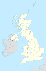
Spalding is a town on Welland in the district of South Holland in the county of Lincolnshire , England . The city is best known as a growing area for vegetables and flowers, especially tulips, and its annual flower parade.
Until 2001, Spalding had a twinning with the German city of Speyer .
location
Spalding is located in the eastern English swamp and moorland area of the Fens , which extended to the North Sea ( The Wash ). The water came from the floods of the Witham , Welland , Nene and Ouse rivers . Spalding was exposed to multiple floods. In the Middle Ages, the drainage of the wetlands began, but the danger of flooding was only averted when the Coronation Canal was completed in 1953. Today, many canals in the area are used for recreational enjoyment.
history
The name of the city goes back to the Spaldingas tribe , who belonged to the Angles and who settled in the area in the 6th century. In 1015 a Benedictine abbey was founded by Thorold de Bokenhale . The village was mentioned in 1086 as Spallinge in the Domesday Book . The church of St Mary & St Nicolas was built around 1284.
The Spalding Grammar School was founded in 1588 and the first drainage canals were built in the 1590s.
A high bridge over the Welland was built in 1838. The Spalding Free Press newspaper was founded in 1847. In 1848 the rail connection was made by the Great Northern Railway .
In 1941, during the Second World War , it was bombed by a stray Luftwaffe machine .
In 1974 the administrative county of Holland was dissolved as part of an administrative reform . Spalding became the administrative seat of the new South Holland district.
In 2008 the radio station Tulip Radio received a full broadcast license.
Population development
- 1801 - 3,296 inhabitants
- 1831 - 6,497 inhabitants
- 1851 - 8,829 inhabitants
- 1871 - 9,111 inhabitants
- 1891 - 9,014 inhabitants
Web links
- Spalding Online
- World Tulip Summit 2008
- Spalding Flower Parade
- Spalding information
- Welland photographs from source to estuary taking in Spalding
Individual evidence
- ↑ The History of the Land ( Memento of the original from November 19, 2007 in the Internet Archive ) Info: The archive link was inserted automatically and has not yet been checked. Please check the original and archive link according to the instructions and then remove this notice.
- ↑ Spalding History - local history, historic sites and famous people from Spalding ( Memento of the original from September 12, 2012 in the web archive archive.today ) Info: The archive link was inserted automatically and has not yet been checked. Please check the original and archive link according to the instructions and then remove this notice.
Coordinates: 52 ° 47 ' N , 0 ° 9' E


