
River Great Ouse
| River Great Ouse | ||
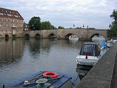
 The Great Ouse at Over in Cambridgeshire |
||
| Data | ||
| location | East england | |
| River system | Great Ouse | |
| Drain over | The Wash → North Sea | |
| River basin district | Anglian | |
| source | Wappenham, South Northamptonshire 52 ° 5 ′ 33 ″ N , 1 ° 5 ′ 35 ″ W. |
|
| Source height | 150 m | |
| muzzle |
The Wash ( North Sea ) coordinates: 52 ° 47 ′ 47 " N , 0 ° 21 ′ 53" E 52 ° 47 ′ 47 " N , 0 ° 21 ′ 53" E |
|
| Mouth height | 0 m | |
| Height difference | 150 m | |
| Bottom slope | 0.56 ‰ | |
| length | 270 km | |
| Catchment area | 8530 km² | |
| Discharge at the Denver Complex A Eo gauge : 3570 km² |
MQ 1970-1993 Mq 1970-1993 |
15.35 m³ / s 4.3 l / (s km²) |
| Outflow A Eo : 8530 km² |
MQ 1970-1993 Mq 1970-1993 |
35 m³ / s 4.1 l / (s km²) |
| Left tributaries | Old Croft , New Bedford River , Old Bedford River | |
| Right tributaries | Cam , Lark , Little Ouse , Wissey | |
| Medium-sized cities | Bedford , King's Lynn | |
| Small towns | Huntingdon , Ely , Downham Market | |
The River Great Ouse (pronounced [ɡɹeɪt ˈuːz] ) is a 270 km long river in eastern England .
course
The Great Ouse flows through Buckingham , Milton Keynes , Olney , Bedford , St Neots , Godmanchester , Huntingdon , St. Ives , Ely , Littleport , Downham Market and then flows into The Wash estuary near King's Lynn . It is East Anglia's main shipping route . The lower course of the river is also known as the Old West River and The Ely Ouse .
Tributaries
- New Bedford River
- Old Bedford River
- Cam
- Ivel
- Lark
- Little Ouse
- Nar
- Wissey
Great Ouse in Huntingdon
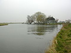
The mouth of the Cam


Web links
Commons : River Great Ouse - collection of images, videos and audio files
swell
- ↑ a b Environment Agency: Great Ouse Catchment Flood Management Plan - Draft Plan ( Memento of the original dated December 3, 2013 in the Internet Archive ) Info: The archive link was inserted automatically and has not yet been checked. Please check the original and archive link according to the instructions and then remove this notice. , 2010 (accessed on November 23, 2013, pdf, English; 8.2 MB)
- ↑ Note: The catchment area of 8,596 km² specified by the Environment Agency also includes the catchment areas of the River Ingol and Heacham River, which do not flow into the Great Ouse, but rather directly into the North Sea . Their catchment areas totaling 66 km² have been factored out.
- ↑ NR Nawaz, AJ Adeloye: Evaluation of monthly runoff estimated by a rainfall runoff-regression model for reservoir assessment yield , Hydrological Sciences, 44 (1), pp 113-134, 1999 (page 120)
- ↑ Extrapolation of the Denver Complex level value for the entire catchment area, rounded off with regard to the precipitation distribution in the entire catchment area