St Mary's (Isles of Scilly)
| St Mary's | ||
|---|---|---|
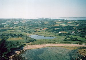
| St Mary's viewed from the air | ||
| Waters | Celtic sea | |
| Archipelago | Isles of Scilly | |
| Geographical location | 49 ° 55 '25 " N , 6 ° 17' 50" W | |
|
|
||
| length | 3.9 km | |
| width | 2.9 km | |
| surface | 6.29 km² | |
| Highest elevation | Mount Todden 36 m ASL |
|
| Residents | 1666 (2001) 265 inhabitants / km² |
|
| main place | Hugh Town | |
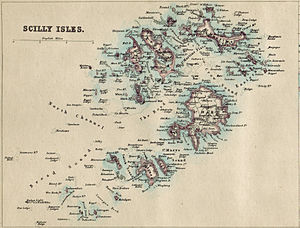
| Isles of Scilly on historical map from 1874 | ||
St Mary’s ( Cornish : Ennor ) is the largest of the Isles of Scilly . The capital, Hugh Town , was sold to the local population by the United Kingdom in 1949 . The rest of the island is part of the Duchy of Cornwall . Other settlements on St Mary's include Old Town , Porthloo , Holy Vale , Maypole , Rocky Hill and Telegraph . The island also became the home of British Prime Minister Harold Wilson , who was buried there in 1995. With St Mary's Airport , St Mary's is also the most important airport in the archipelago.
Attractions
- Bant's Carn , Bronze Age grave on a hill above Halangy Down
- Carn Gwavel , basement , on private property
- Halangy Down , Iron Age Village
- Porth Hellick Down , Entrance Grave of the type “Scillonian entrance graves”
Web links
Commons : St Mary’s - collection of images, videos and audio files


