St Alban's Head
| St Alban's Head | ||
 Limestone cliffs, St Alban's Head |
||
| Geographical location | ||
|
|
||
| Coordinates | 50 ° 34 '44 " N , 2 ° 3' 23" W | |
| Waters 1 | English Channel | |
St Alban's Head is a headland. St Alban's Head is a corruption of the correct name St Aldhelms Head . The headland is an extension of the Portland Stone and the Purbeck Stone above.
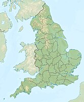
St Alban's Head lies two kilometers directly south of Worth Matravers , the English Channel , on the Isle of Purbeck in the county of Dorset , on the south coast of England . St Alban's Head is about seven kilometers southwest of Swanage , and about five kilometers south of Corfe Castle and Corfe Castle . The headland is the southernmost point of the Purbeck peninsula.
There is a Norman chapel on St Alban's Head . St Aldhelm's Chapel is dedicated to St Aldhelm , Bishop of Sherborne . He died in AD 709. The chapel could have been built in the early twelfth century.
The Isle of Purbeck has a long quarry history, especially along the cliffs to the south. The quarries were the largest suppliers of Purbeck stone and Purbeck marble . "St Aldhelms Quarry" owned by Haysom and Sons (a well known local quarry family) is still operating a quarter of a mile inland from St Alban's Head.
The coast and cliffs along East Devon and Dorset on the English Channel are some of the natural wonders of the world. From Orcombe Point , near Exmouth , to Old Harry Rocks , east of Studland Bay , there is a 155-kilometer stretch of coastline that was the first natural landscape in England to be declared a UNESCO World Heritage Site. The headland of St Alban's Head is part of the Jurassic Coast .
- See also: List of Places along the Jurassic Coast
Individual evidence
- ^ Dorset and East Devon Coast . UNESCO World Heritage Center. 2001. Retrieved October 31, 2010.

