Stankau pond
|
Stankau pond Staňkovský rybník |
||
|---|---|---|

|
||
| View from the small peninsula in northeast direction | ||
| Geographical location | Wittingau basin near Staňkov ( Czech Republic ) | |
| Tributaries | Neumühlbach / Koštěnický potok | |
| Drain | Neumühlbach / Koštěnický potok | |
| Location close to the shore | Jindřichův Hradec | |
| Data | ||
| Coordinates | 48 ° 58 '39 " N , 14 ° 57' 15" E | |
|
|
||
| Altitude above sea level | 469 m | |
| surface | 2.41 km² | |
| length | 6 km | |
| volume | 6,600,000 m³ | |
| scope | 21 km | |
| Maximum depth | 14 m | |
| Middle deep | 7 m | |
|
particularities |
most water-rich pond in the Czech Republic |
|
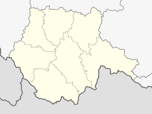
The Stankau Pond ( Staňkovský rybník in Czech ) is a pond in southern Bohemia . It lies east of Staňkov on the state border between the Czech Republic and Austria . In terms of the amount of dammed water, it is the largest fish pond in the Czech Republic with 6.6 million cubic meters, and with a maximum depth of 16 meters at the dam, it is also the deepest. The border with Austria runs along the northeastern bank. It is fed by the Neumühlbach (Koštěnický potok).
geography
The pond is located at the transition from the Javořická vrchovina to the Wittingau basin / Třeboňská pánev . Its dam is located on a ridge near the Staňkov municipality. The pond encompasses the depression to the east of it and then extends for five and a half kilometers in the valley of the Neumühlbach / Koštěnický potok behind it along the Czech-Austrian border to Černý kříž. On the north-eastern bank there is a meridian stone in the Rottaler Forest in Austria , which marks the intersection of the 15th longitude and 49th parallel .
The Stankau pond is largely enclosed by forests. On the Austrian side are the Hüttenforst and the Rottaler Forst, in the north lies the Zadní les ( Hinterwald ).
Surrounding settlements are Hajnice in the northwest, Rottal and Lerchenfeld in the northeast, Waldhäuser, Josefstal and Kashof in the east, Schlag in the southeast, Tundr, Pele, Moštěnice and Na Chalupách in the south and Staňkov in the southwest.
The southern bay was separated from the original pond by a dam, from which the Špačkov pond was created. Together with the side pond Špačkov, the Stankau pond has a water surface of 273 ha.
history
The pond was created from 1550 onwards by the pond builder Mikuláš Ruthard z Malešova ( Nikolaus Ruthard von Maleschau ) in an uninhabited forest area on behalf of Mr. Kraigk von Kraigk on Neubistritz . The pond was originally named Soused . In the following years, individual farmers settled around the dam and a hundred years later the village of Stankau / Staňkov emerged . In the course of time the pond was named Velký Bystřický rybník / Big Bistritz Pond and after the further development of the village of Staňkov it was called Stankauer Pond or Staňkovský rybník .
At the construction of the Stankau pond, a 160 m high earth embankment was built. The main purpose of the structure was to protect the deeper pond system around the town of Chlum u Třeboně / Chlumetz , for which Nikolaus Ruthard was also responsible, from flooding. From the beginning, the Stankau pond was not designed as a commercial fish pond, but rather as a dam . The large amount of water that it was supposed to hold gave cause for concern during construction; in fact, the dam broke during an extreme flood in 1581 and the water poured down to the ponds around Třeboň / Wittingau . Overall, however, it fulfilled its purpose and also helped to drain the surrounding landscape and prepare it for settlement.
Because of its depth, the Stankau pond is also unsuitable for modern commercial pond management . But it has clear water, a sandy bottom and sandy beaches on the wooded shore. Therefore it is mainly used by bathers and sport anglers.
The use of the pond for recreational purposes began after the First World War . In 1920 the YMCA established a summer camp. In the 1950s, the construction of the Iron Curtain made the pond inaccessible and became a restricted area. After the Velvet Revolution , the area could be opened up again for tourism. There are several campsites by the pond on the west bank near Staňkov.
Web links
- www.jiznicechy.org - Staňkovský rybník pond (cz / de)
- www.naryby.cz - Staňkovský pond , fishing portal (cz / de)
- www.rozhlas.cz , Czech Radio series about ponds and pond builders in South Bohemia. Part 10 describes the construction of the Stankau pond (cz)
