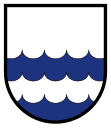
Chlum u Třeboně
| Chlum u Třeboně | ||||
|---|---|---|---|---|
|
||||
| Basic data | ||||
| State : |
|
|||
| Region : | Jihočeský kraj | |||
| District : | Jindřichův Hradec | |||
| Area : | 4738 ha | |||
| Geographic location : | 48 ° 57 ' N , 14 ° 56' E | |||
| Height: | 492 m nm | |||
| Residents : | 1,959 (Jan 1, 2019) | |||
| Postal code : | 378 04 | |||
| License plate : | C. | |||
| traffic | ||||
| Street: | Jindřichův Hradec - Suchdol nad Lužnicí | |||
| structure | ||||
| Status: | Městys | |||
| Districts: | 4th | |||
| administration | ||||
| Mayor : | Petr Kolezsar (as of 2018) | |||
| Address: | Náměstí 115 378 04 Chlum u Třeboně |
|||
| Municipality number: | 546461 | |||
| Website : | www.chlum-ut.cz | |||
Chlum u Třeboně (German Chlumetz ) is a place in the Czech Republic . It is located 25 kilometers south of Jindřichův Hradec near the Austrian border and belongs to the Okres Jindřichův Hradec .
geography
Chlum u Třeboně is located in the southwest of the Javořická vrchovina on the edge of the Wittingau basin in the valley of the Koštěnický potok . The place is located at the Hejtman pond and is surrounded by a large number of other ponds. To the east there is the migration border crossing Chlum u Třeboně / Schlag to Austria.
Neighboring towns are Lutová in the north, Staňkov in the northeast, Lomy, Moštěnice and Pele in the east, Lipovky in the southeast, Josefovo Údolí and Pařezí in the south, Hamr in the southwest and Majdalena in the west.
history
The first documentary mention of the place comes from the year 1399, when the hospital in the Schweinitzer suburb of Třeboň the Vorwerk Chlumetz of Heinrich III. von Rosenberg bought. At the beginning of the 15th century, the Rosenbergs bought back the area around Chlum. Mining on iron ore began around 1450 and in 1476 feuds broke out between Bohemian and Austrian knights after they had invaded the area. At the beginning of the 16th century, Chlumetz fell in the course of an exchange of territory with the Kraigk Kraigk to the rule of Bystřice . From 1520 Wolf Kraiger von Kraigk had the Koštěnický potok dammed and fish ponds created. In 1575 Johann the Elder from Lobkowicz acquired Chlumetz, followed in 1604 by Radslav from Wchynitz and Tettau and then by Wilhelm Slavata in 1615 . In 1693, a plague of locusts destroyed the entire harvest. In the same year, Johann von Fünfkirchen acquired the rule and released it from Bystřice in 1704. In 1710 the castle was converted into a mansion. In 1781 the ironworks Josephstal was founded. In 1834 Eduard Graf zu Stadion-Thannhausen acquired Chlumetz. After patrimonial was replaced , Chlumetz became an independent market town in 1848. In 1861, Francis V of Modena acquired the castle with the goods. After his death it was inherited by Franz Ferdinand of Austria-Este . He had the castle completely renovated including an increase and a second entrance built in 1901. At that time the property was 6,539 hectares, of which 7450 hectares were agricultural and 40 ponds with 1,268 hectares. Stölze's glassworks were founded as early as 1891 .
After the collapse of the Austro-Hungarian monarchy , the castle and the property of the children of the heir to the throne Archduke Franz Ferdinand were expropriated and placed under the Czechoslovak state estates and forests in Prague. The reconstruction, the expropriation and the unsuccessful restitution claims of the Hohenberg family are documented in Artstetten Castle. The castle then served the ministerial bureaucracy as a resort. In 1941 it was cleared and used as a warehouse for the German armed forces . Then it was converted into a boarding school for apprentices and a rest home. The ponds were opened up for tourism in the 1920s and a summer camp was set up by the YMCA on Staňkovský rybnik . In 2004 the glassworks was sold and then shut down. Chlum u Třeboně is now a resort with several campsites. In 2006 the place was raised to Městys .
Community structure
The municipality of Chlum u Třeboně consists of the districts Chlum u Třeboně ( Chlumetz ), Lutová ( Luttau ), Mirochov ( Mirochau ) and Žíteč ( Sichs ), which also form cadastral districts. Chlum u Třeboně also includes u. a. the settlements Josefovo Údolí ( Josephsthal ), Lipovky ( Lipowky ), Nová Huť ( Fichtenthal ), Pařezí ( Parezy ), Předměstí and Žabárna ( capercaillie ). Basic settlement units are Chlum u Třeboně, Lipovky, Lutová, Mirochov, Pařezí, Předměstí, V Chalupách, V Koutech, Velký Kopec and Žíteč.
Attractions
- Hejtman pond, built 1560–1570, with 85 hectares of water
- Chlum u Třeboně Castle, built in 1710 by rebuilding the old castle
- Baroque Church of the Assumption, on the market, with the Way of the Cross
literature
- Jiří Černý: Poutní místa Soběslavska a Třeboňska s přilehlou částí Dolních Rakous. Milostné obrazy, sochy a místa zvláštní zbožnosti. Veduta, České Budějovice 2009, ISBN 978-80-86829-44-9 .
Web links
Individual evidence
- ↑ http://www.uir.cz/obec/546461/Chlum-u-Trebone
- ↑ Český statistický úřad - The population of the Czech municipalities as of January 1, 2019 (PDF; 0.8 MiB)
- ^ Archives Castle Artstetten / Chlumetz.
- ↑ http://www.uir.cz/casti-obce-obec/546461/Obec-Chlum-u-Trebone
- ↑ http://www.uir.cz/katastralni-uzemi-obec/546461/Obec-Chlum-u-Trebone
- ↑ http://www.uir.cz/zsj-obec/546461/Obec-Chlum-u-Trebone


