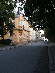
České Velenice
| České Velenice | ||||
|---|---|---|---|---|
|
||||
| Basic data | ||||
| State : |
|
|||
| Historical part of the country : | Lower Austria | |||
| Region : | Jihočeský kraj | |||
| District : | Jindřichův Hradec | |||
| Area : | 1209 ha | |||
| Geographic location : | 48 ° 46 ' N , 14 ° 58' E | |||
| Height: | 489 m nm | |||
| Residents : | 3,521 (Jan 1, 2019) | |||
| Postal code : | 378 10 | |||
| License plate : | C. | |||
| traffic | ||||
| Street: | Třeboň - Gmünd | |||
| Railway connection: |
České Budějovice – Gmünd České Velenice – Veselí nad Lužnicí |
|||
| structure | ||||
| Status: | city | |||
| Districts: | 1 | |||
| administration | ||||
| Mayor : | Jaromír Slíva (as of 2018) | |||
| Address: | Revoluční 228 378 10 České Velenice |
|||
| Municipality number: | 546089 | |||
| Website : | www.velenice.cz | |||
České Velenice (German Gmünd-Bahnhof , originally Unterwielands , 1938-1945: Gmünd III ) is a town with almost 4,000 inhabitants in the Okres Jindřichův Hradec . It belongs to the South Bohemian Region .
geography
České Velenice is located on the left bank of the Lainsitz , which forms the border with Austria here. On the opposite side of the river is the Austrian town of Gmünd , to which a railway line and a road lead. In the northeast, České Velenice borders the Gmünd district of Böhmzeil, to which a road approved for motor vehicle traffic leads. The Austrian town of Wielands is located southwest of the city . The city, which is surrounded on three sides by Austrian territory, is only connected to Czech territory in the northwest.
history
With the construction of the Kaiser-Franz-Josefs-Bahn in 1870, a train station for the city of Gmünd was built in the corridors of the village of Wielands . The emerging settlement of Unterwieland quickly developed into a district of Gmünd. From 1907 to 1916 it was connected to the Gmünd city center by the Gmünd electrical overhead line . After the founding of Czechoslovakia in 1918 , it was awarded areas of Austria near the border in 1920, including parts of the urban area of Gmünd on the left of the Lainsitz .
The district of Gmünd-Bahnhof ( České Velenice ), to which Josefschlag ( Žižkovo Předměstí ) and part of Böhmzeil ( Česká Cejle ) belonged, became an independent town in Czechoslovakia. The current Czech name means “Bohemian Wielands” and therefore does not refer to Gmünd, but to the smaller, southern Wielands which remained in Austria. Between 1938 and 1945 the city was reunited with Gmünd under the name Gmünd III .
Culture and sights
Museums
- GaMu - Gallery a Muzeum České Velenice, třída Čsl. legií 1
Buildings
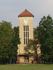
- Church of St. Agnes of Bohemia
- town hall
traffic
The city has a train station in European standard. It connects the railway line from Budweis with the railway line to Vienna.
sons and daughters of the town
- Adolf Born (1930–2016), Czech caricaturist and graphic artist
- Anton Legner (* 1928), art historian


