Sterling (Massachusetts)
| sterling | ||
|---|---|---|
|
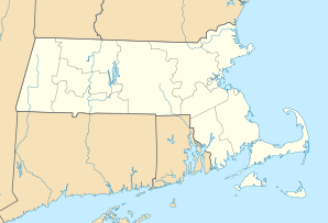
Location in Massachusetts
|
||
| Basic data | ||
| Foundation : | 1720 | |
| State : | United States | |
| State : | Massachusetts | |
| County : | Worcester County | |
| Coordinates : | 42 ° 26 ′ N , 71 ° 46 ′ W | |
| Time zone : | Eastern ( UTC − 5 / −4 ) | |
| Residents : | 7,808 (as of 2010) | |
| Population density : | 98.8 inhabitants per km 2 | |
| Area : | 81.8 km 2 (approx. 32 mi 2 ) of which 79.0 km 2 (approx. 31 mi 2 ) are land |
|
| Height : | 190 m | |
| Postal code : | 01564 | |
| Area code : | +1 351 / +1 978 | |
| FIPS : | 25-67385 | |
| GNIS ID : | 0619490 | |
| Website : | www.sterling-ma.gov | |
Sterling is a place in Worcester County, Massachusetts with 7,808 inhabitants (2010). It is located on the eastern edge of the Boston metropolitan area on a plain rich in forests and lakes. The place mainly serves as a dormitory for the surrounding metropolitan areas and as a location for small and medium-sized, mostly agricultural industries.
The area of today's parish was originally inhabited by a tribe of the Nashaway Indians. The first white settlers had invaded the area as early as 1640; There is a first written report of the contacts with the Nashaway from 1643. At that time, 14 Indian families lived in three villages in the area. During the Indian uprising in 1675/76 the settlers withdrew and did not return until around 1700. The area was largely deserted at this point; the traditions speak of only three families left. Large areas, including the area of today's Sterling parish, were bought from the Indians in two steps in 1701 and 1702 and initially added to the parish of Lancaster . The reclamation by European settlers began around 1720; around 1740 50 families settled in what is now Sterling. In 1743 a community hall, a school and a common cattle shed were built. In 1764 856 people lived here; the settlement was then called Chocksett , after the local expression for "land of the foxes". In 1781 the parish of Lancaster became independent and named after William Alexander, Earl of Stirling , a general in the War of Independence under George Washington .
The traffic connection of the place is given by the Interstate 192 , which runs from northeast to southwest through the place and connects it with the cities Leominster and Worcester . A small airport about 3.5 km from the town center serves local air traffic. A rail link that has existed since 1848 has only been used for freight traffic since 1961.
Since the 2007/2008 season, the area around the town has hosted a number of cross-country cycling races .
sons and daughters of the town
- Prentiss Mellen (1764-1840), Senator
- Le Gage Pratt (1852–1911), Member of the House of Representatives
Surrounding communities
All information as the crow flies.
- North: Leominster , 6.2 mi
- Northeast: Lowell , 25 miles
- East: Boston , 58.2 mi
- Southeast: Marlborough , 12 mi
- South: Worcester , 12 mi
- West: Amherst , 63.0 km
- Northwest: Gardner , 15 miles
Individual evidence
- ↑ Historical outline on the city's website (English) ( Memento of the original from May 2, 2013 in the Internet Archive ) Info: The archive link was inserted automatically and has not yet been checked. Please check the original and archive link according to the instructions and then remove this notice.
- ↑ Navigation data for Sterling Airport
Web links
