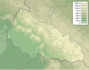
Stij
|
Stij Стій |
||
|---|---|---|
|
View of the Stij |
||
| height | 1681 m | |
| location |
Zakarpattia Oblast , Ukraine |
|
| Mountains | Carpathian Mountains , Polonina Ridge | |
| Coordinates | 48 ° 37 '17 " N , 23 ° 11' 26" E | |
|
|
||
The Stij ( Ukrainian Стій , Russian Стой Stoi , Hungarian Sztoj , polish Stoj ) is connected to an altitude of 1681 m of the highest mountain in the massif Polonyna Borschawa ( Полонина Боржава ) of the Waldkarpaten in the Ukrainian oblast Transcarpathians on the boundary of Rajone Mizhhirya and Svalyava .
On the flat top of the mountain there is a concrete column and the ruins of a large radar system and associated shelters, which were in operation until the end of the 1990s and then abandoned and destroyed by snow and wind.
The national nature reserve is located on the western slopes of the mountain Rossischnyj ( Росішний заказник ). They are steep, in the lower part covered with beech forests and individual spruce and fir trees and above the tree line there are large areas with blueberry growth . The southern and eastern slopes are flatter and with meadows from u. a. Overgrown lawn curls . On the north side of the mountain there are steep, rocky cliffs, on which rare plants such as Swiss stone pine and chamois heather can be found in Ukraine .
The nearest villages are the villages Beresnyky the south and Volovets the north. In good weather, the view extends from the summit to the southwest to the city of Mukachevo and to the northwest to the 1408 m high Pikuj in the south of the Lviv Oblast .
Below the mountain is the source of the Borschawa .
Web links
- The history of the military object in the Carpathian Mountains on igormelika.com.ua (Ukrainian)
Individual evidence
- ↑ Mount Stij on geonames ; accessed on January 30, 2019 (Ukrainian)
- ^ Institute for Natural Sciences, Geography and Natural History - The highest peaks of the Ukrainian Carpathians and their geomorphological regions ; accessed on January 30, 2019 (Ukrainian)
- ↑ a b Berg Stij (1681.5m): map, photo, description on drymba.com ; accessed on January 30, 2019 (Ukrainian)
- ↑ Stij on karpaty.com.ua ; accessed on January 30, 2019 (Ukrainian)


