Stoney Creek Independent Presbyterian Chapel of Prince William Parish
Coordinates: 32 ° 41 ′ 31.5 " N , 80 ° 54 ′ 53" W.
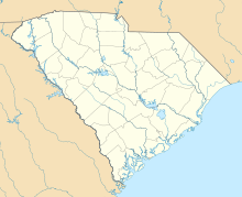
The Stoney Creek Independent Presbyterian Chapel of Prince William Parish or Stoney Creek Presbyterian Chapel is a chapel in southeast Hampton County , South Carolina in the United States. It is located about six kilometers west of Yemassee in the unincorporated village of McPhersonville . In the Geographic Names Information System of the United States Geological Survey , the structure is listed as McPhersonville Church . The structure was built around 1833. It stands one block north of Pocotaglio Road (State Highway 25-17) on State Highway 25-286. The chapel is the only structure from the Antebellum in McPhersonville. It was added to the National Register of Historic Places on May 22, 2002 .
history
In 1743 a group of local citizens founded the non- Anglican Stoney Creek Church near Pocotaligo on the Pocotaglio River . The pastor was William Hutson, a student of George Whitefield . In 1785 the church was reorganized as the Independent Presbyterian Chapel of Prince William Parish.
Before the American Civil War , many of the rice planters from the Prince William Parish built summer homes in McPhersonville, which was then part of the Beaufort District . This enabled them to spend the hot summer months, when there were many malaria-infected mosquitoes, in somewhat higher areas. In 1832 some of the planters provided an acre to build a chapel for the summer time.
During the Civil War, the chapel was used by the Union Army as a hospital and storage area. The Stoney Creek Presbyterian Church on the Pocotaligo River - the chapel's mother church - was dismantled to use the material in building a bridge and other structures.
After the war, the community used the McPhersonville Summer Chapel. Its strength decreased more and more, and finally the church dissolved in 1967. The chapel was placed under the jurisdiction of the First Presbyterian Church of Beaufort.
architecture
The chapel is a simple, classical building with a south-west facing portico and a gable roof . The floor plan is rectangular with a small polygonal choir extension on the north-eastern narrow side. The rectangular portion of the building is approximately 40 feet (12 meters) long and 24 feet (7.2 meters) wide. The portico at the front is 11 feet (3.3 m) deep and 12 feet (around 7.2 m) wide, and has four Doric pine pillars that stand on wooden bases. The gable triangle on the front is simple. There is a round window above the central door. All windows on the long sides as well as on the entrance side are designed as sliding windows with arched skylights and blinds . The small choir located on the north-eastern narrow side of the chapel is built on a semi-hexagonal floor plan, it has two smaller arched windows. An octagonal roof turret with windows on four sides was completed in 1890 on the portico. The top of the roof turret is decorated with a wooden tower ball .
Inside, the walls are smoothly plastered . The pews date from the time the chapel was built; the floor is made of wide pine planks. At the rear end of the church the floor is raised by two steps as a podium up to the choir. An artificial harmonium made by Farrand & Votey is located just in front of the rear door in the northeast corner of the building. On the podium there is also a white lacquered wooden pulpit, in front of which is the also white lacquered communion table. The pendant lights, originally designed as oil lamps, have been converted to electrical lighting.
Web links
- Jack Boucher: Stoney Creek Presbyterian Church, 1 block North of SC Route 17, McPhersonville, Hampton County, SC (Photographs) ( English ) In: Historic American Building Survey . Library of Congress . March 1987. Retrieved July 19, 2011.
supporting documents
- ↑ McPhersonville Church ( English ) In: Geographic Names Information System . United States Geological Survey . Retrieved July 19, 2011.
- ↑ a b c d e Mary W. Edmonds: Stoney Creek Independent Presbyterian Chapel of Prince William Parish ( English , PDF; 729 kB) In: National Register of Historic Places Inventory - Nomination Form . National Park Service. March 28, 2002. Retrieved July 19, 2011.
- ↑ Google (in English). + 32 ° 41 '31.50 ", -80 ° 54' 53.00 [map]. Accessed July 19, 2011.
- ^ Stony Creek Independent Presbyterian Chapel of Prince William Parish, Hampton County (McPhersonville) ( English ) In: National Register Properties in South Carolina . South Carolina Department of Archives and History. Retrieved July 19, 2011.
- ^ Pocotaligo River ( English ) In: Geographic Names Information System . United States Geological Survey . Retrieved July 19, 2011.
- ↑ Lawrence Sanders Rowland, Alexander Moore, George C. Rogers: The History of Beaufort County, South Carolina: 1514–1861 . University of South Carolina Press, Columbia, South Carolina 1996, ISBN 1-57003-090-1 , pp. 117 ( online ).
- ^ A b c d Milton Wilmesherr: Independent Church of Indian Land . In: Sandlapper Press (Ed.): Sandlapper . 3, No. 4, Columbia, South Carolina, Apr. 2009, p. 71.
- ↑ Nomination form of the National Register, page 5 (PDF file in English, accessed on July 21, 2011; 712 kB)

